MyTopo
Devils Slide Washington US Topo Map
Couldn't load pickup availability
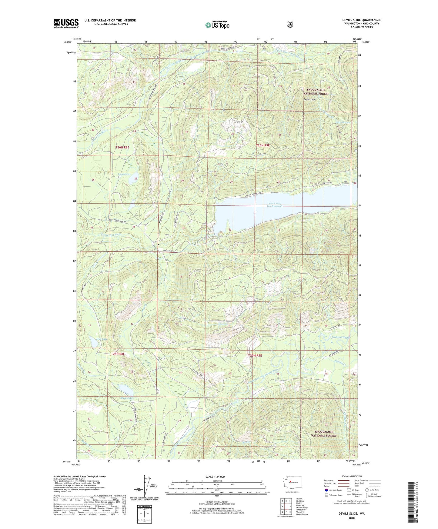
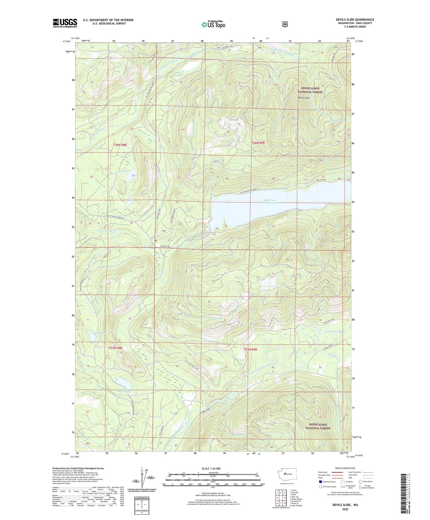
2020 topographic map quadrangle Devils Slide in the state of Washington. Scale: 1:24000. Based on the newly updated USGS 7.5' US Topo map series, this map is in the following counties: King. The map contains contour data, water features, and other items you are used to seeing on USGS maps, but also has updated roads and other features. This is the next generation of topographic maps. Printed on high-quality waterproof paper with UV fade-resistant inks.
Quads adjacent to this one:
West: Lake Joy
Northwest: Sultan
North: Gold Bar
Northeast: Index
East: Mount Phelps
Southeast: Lake Philippa
South: Mount Si
Southwest: Snoqualmie
Contains the following named places: Big Creek, Black Lake, Deep Creek, Devils Slide, Dry Creek, Fitchener Slough, Lake Titicaca, Lynch Lake, Mud Lake, North Fork Tolt Watershed, Philippa Creek, South Fork Tolt Reservoir, Sunday Creek, Titicaca Creek, Tolt River Dam