MyTopo
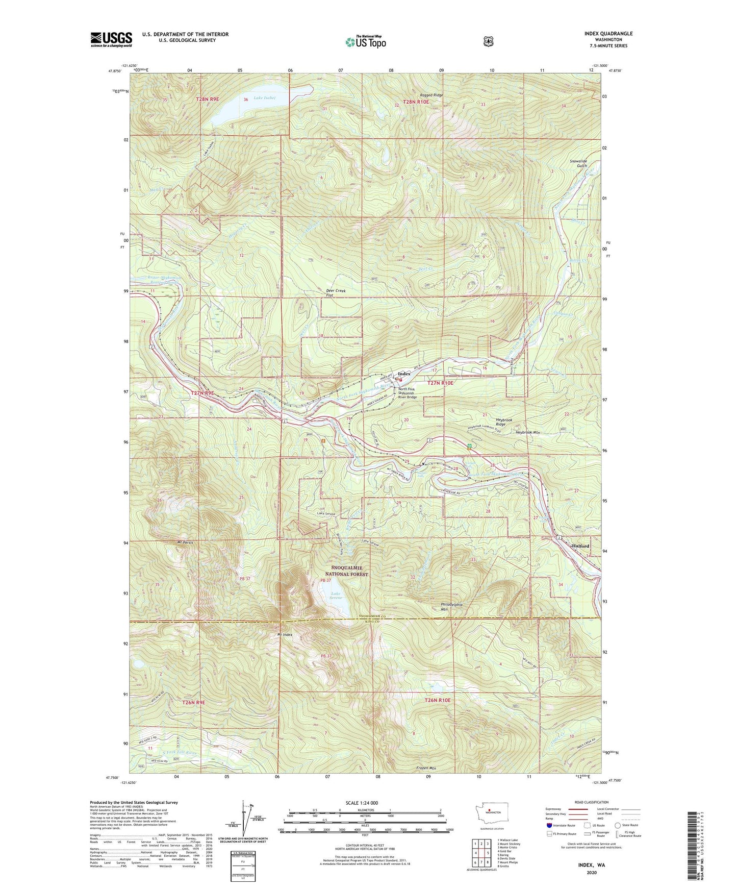
Index Washington US Topo Map
Couldn't load pickup availability
Also explore the Index Forest Service Topo of this same quad for updated USFS data
2023 topographic map quadrangle Index in the state of Washington. Scale: 1:24000. Based on the newly updated USGS 7.5' US Topo map series, this map is in the following counties: Snohomish, King. The map contains contour data, water features, and other items you are used to seeing on USGS maps, but also has updated roads and other features. This is the next generation of topographic maps. Printed on high-quality waterproof paper with UV fade-resistant inks.
Quads adjacent to this one:
West: Gold Bar
Northwest: Wallace Lake
North: Mount Stickney
Northeast: Monte Cristo
East: Baring
Southeast: Grotto
South: Mount Phelps
Southwest: Devils Slide
This map covers the same area as the classic USGS quad with code o47121g5.
Contains the following named places: Anderson Creek, Austin Creek, Barclay Creek, Bitter Creek, Boss Creek, Bridal Veil Creek, Bridal Veil Falls, Canyon Creek, Canyon Falls, Copperbelt Mine, Deer Creek, Deer Creek Flat, Eagle Falls, East Fork Index Creek, Halford, Heybrook Lookout, Heybrook Mountain, Hogarty Creek, Honeymoon Mine, Index, Index Elementary School, Index Post Office, Lake Isabel, Lake Serene, Lewis Creek, Mount Index, Mount Persis, Noname Creek, North Fork Guard Station, North Fork Skykomish River, North Fork Skykomish River Bridge, North Star Creek, Philadelphia Creek, Philadelphia Mountain, Ragged Ridge, Reiter, Reiter-Skykomish Rearing Ponds, Reiter-Skykomish Rearing Ponds Dam, Snohomish County Fire District 28 Station 55, Snowslide Gulch, South Fork Skykomish River, Sunset Falls, Town of Index