MyTopo
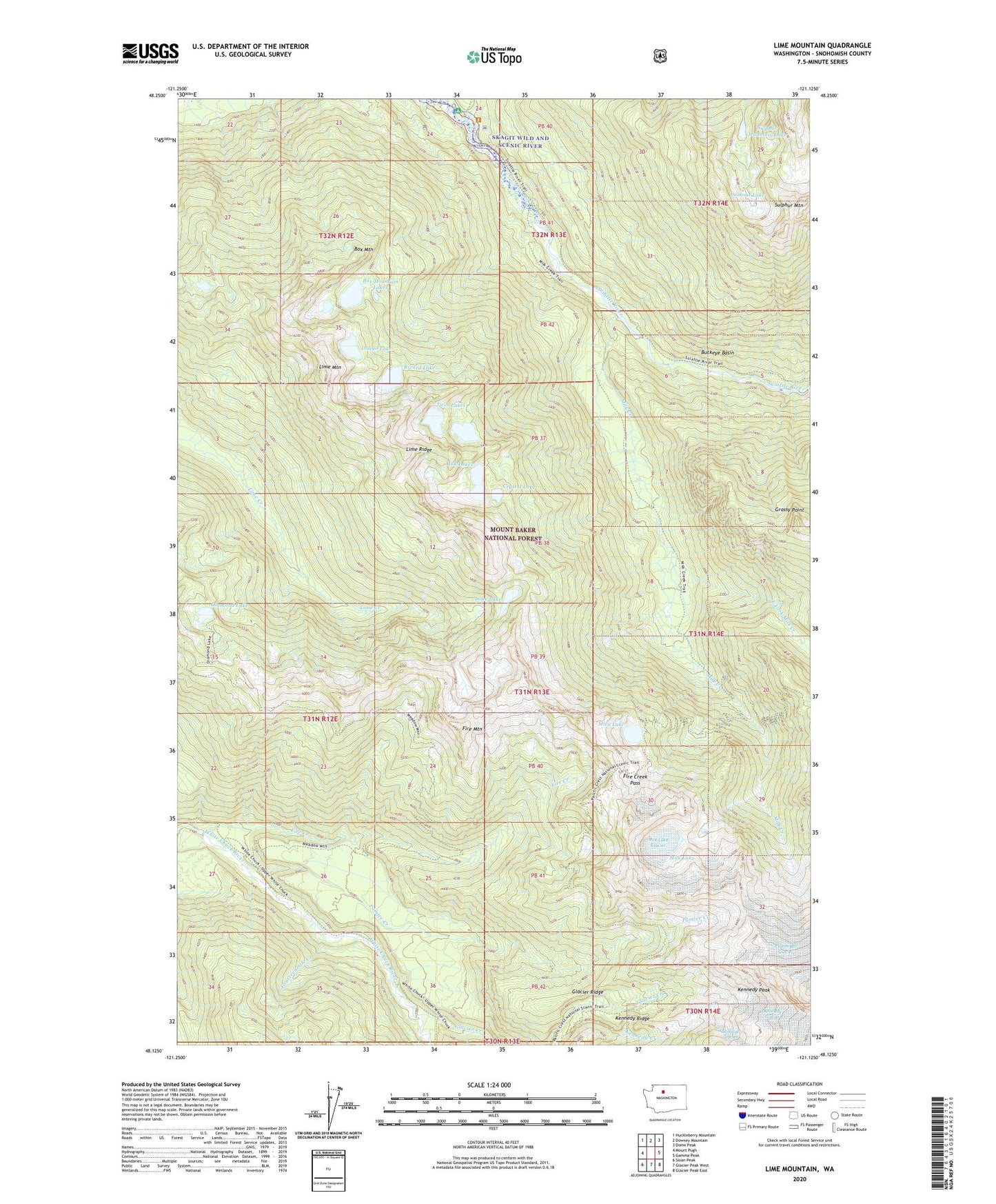
Lime Mountain Washington US Topo Map
Couldn't load pickup availability
Also explore the Lime Mountain Forest Service Topo of this same quad for updated USFS data
2023 topographic map quadrangle Lime Mountain in the state of Washington. Scale: 1:24000. Based on the newly updated USGS 7.5' US Topo map series, this map is in the following counties: Snohomish. The map contains contour data, water features, and other items you are used to seeing on USGS maps, but also has updated roads and other features. This is the next generation of topographic maps. Printed on high-quality waterproof paper with UV fade-resistant inks.
Quads adjacent to this one:
West: Mount Pugh
Northwest: Huckleberry Mountain
North: Downey Mountain
Northeast: Dome Peak
East: Gamma Peak
Southeast: Glacier Peak East
South: Glacier Peak West
Southwest: Sloan Peak
This map covers the same area as the classic USGS quad with code o48121b2.
Contains the following named places: Box Mountain, Box Mountain Lakes, Buckeye Basin, Camp Creek Ridge Trail, Diamond Lake, East Fork Milk Creek, Fire Creek, Fire Creek Pass, Fire Creek Trail, Fire Creek Way, Fire Mountain, Fourteenmile Creek, Glacier Creek, Glacier Ridge, Glacier Ridge Trail, Kennedy Peak, Kennedy Ridge, Kennedy Ridge Trail, Lime Lake, Lime Mountain, Lime Ridge, Lookout Lake, Meadow Mountain Way, Mica Lake, Milk Creek, Milk Lake, Milk Lake Glacier, Milk Lakes, Ptarmigan Glacier, Pumice Creek, Rivord Lake, Suiattle Trailhead, Sulphur Creek, Sulphur Creek Campground, Sulphur Mountain, Sulphur Mountain Way, Twin Lakes, ZIP Code: 98241