MyTopo
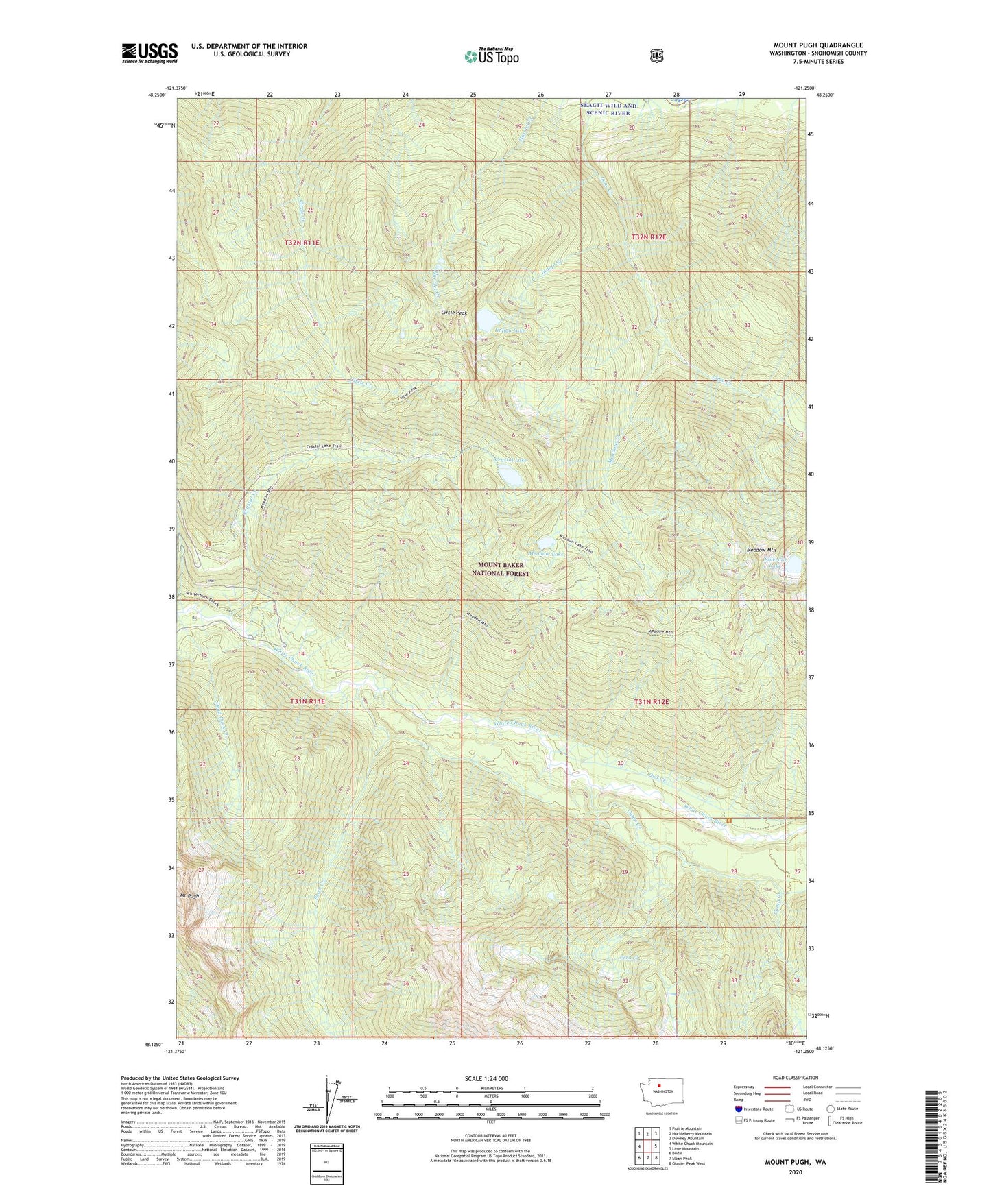
Mount Pugh Washington US Topo Map
Couldn't load pickup availability
Also explore the Mount Pugh Forest Service Topo of this same quad for updated USFS data
2023 topographic map quadrangle Mount Pugh in the state of Washington. Scale: 1:24000. Based on the newly updated USGS 7.5' US Topo map series, this map is in the following counties: Snohomish. The map contains contour data, water features, and other items you are used to seeing on USGS maps, but also has updated roads and other features. This is the next generation of topographic maps. Printed on high-quality waterproof paper with UV fade-resistant inks.
Quads adjacent to this one:
West: White Chuck Mountain
Northwest: Prairie Mountain
North: Huckleberry Mountain
Northeast: Downey Mountain
East: Lime Mountain
Southeast: Glacier Peak West
South: Sloan Peak
Southwest: Bedal
Contains the following named places: Camp Creek, Circle Peak, Crystal Creek, Crystal Creek Campground, Crystal Lake, Darrington Ranger District, Dead Duck Creek, Emerald Lake, Fern Creek, Indigo Creek, Indigo Lake, Meadow Creek, Meadow Lake, Meadow Mountain, Meadow Mountain Trail, Mount Pugh, Owl Creek, Owl Creek Campground, Pugh Creek, White Chuck Trailhead