MyTopo
Jackson Prairie Washington US Topo Map
Couldn't load pickup availability
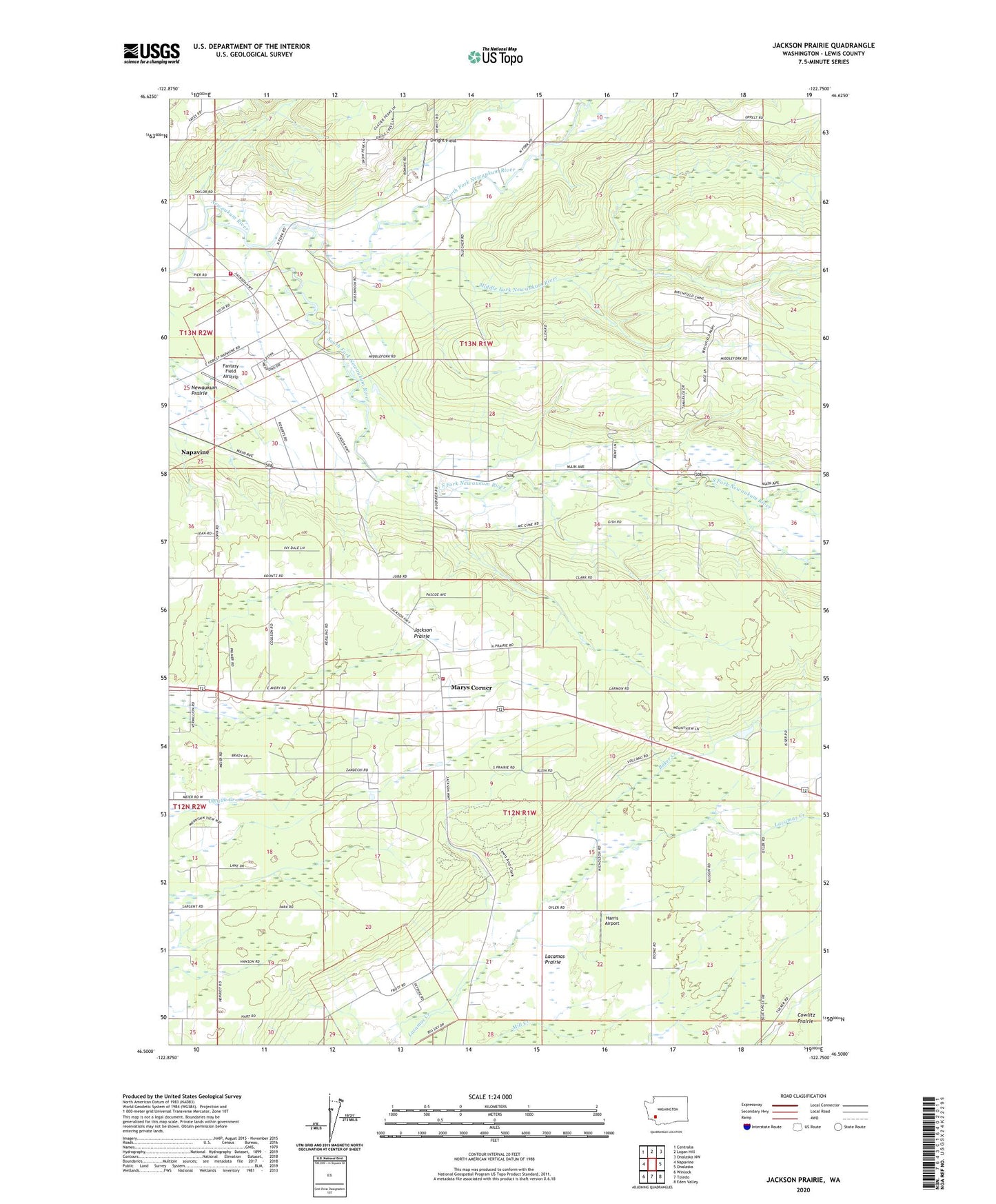
2023 topographic map quadrangle Jackson Prairie in the state of Washington. Scale: 1:24000. Based on the newly updated USGS 7.5' US Topo map series, this map is in the following counties: Lewis. The map contains contour data, water features, and other items you are used to seeing on USGS maps, but also has updated roads and other features. This is the next generation of topographic maps. Printed on high-quality waterproof paper with UV fade-resistant inks.
Quads adjacent to this one:
West: Napavine
Northwest: Centralia
North: Logan Hill
Northeast: Onalaska NW
East: Onalaska
Southeast: Eden Valley
South: Toledo
Southwest: Winlock
This map covers the same area as the classic USGS quad with code o46122e7.
Contains the following named places: Baker Creek, Dwight Field, Fantasy Field Airstrip, Forest, Foster Heliport, Guerrier, Harris Airport, Jackson Court House State Park, Jackson House, Jackson Prairie, Klaus, Lewis and Clark State Park, Lewis County Fire District 5 Station 2, Lewis County Fire District 5 Station 3, Marys Corner, Matilda Jackson State Park, Middle Fork Newaukum River, Mount Saint Helens Visitors Center, North Fork Newaukum River, South Fork Newaukum River, ZIP Code: 98542