MyTopo
Entiat Washington US Topo Map
Couldn't load pickup availability
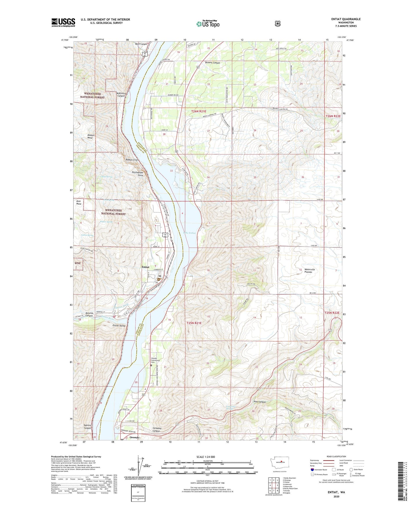
2020 topographic map quadrangle Entiat in the state of Washington. Scale: 1:24000. Based on the newly updated USGS 7.5' US Topo map series, this map is in the following counties: Douglas, Chelan. The map contains contour data, water features, and other items you are used to seeing on USGS maps, but also has updated roads and other features. This is the next generation of topographic maps. Printed on high-quality waterproof paper with UV fade-resistant inks.
Quads adjacent to this one:
West: Ardenvoir
Northwest: Baldy Mountain
North: Winesap
Northeast: Chelan
East: Waterville
Southeast: Douglas
South: Orondo
Southwest: Rocky Reach Dam
Contains the following named places: Brays Landing Cemetery, Browns Canyon, Byrd Canyon, Carpender Springs, Chelan County Fire District 8, City of Entiat, Corbaley Canyon, Coyote Spring, Earthquake Point, Entiat, Entiat Ditch, Entiat Federated Church, Entiat Junior Senior High School, Entiat Post Office, Entiat Ranger Station, Entiat River, Entiat Sewage Treatment Plant, Entiat Valley, Entiat Warehouse Community Church, Friends Church, Indian Spring, Long Spring, McKinstry Canyon, McLeish Canyon, Orondo, Orondo Community Cemetery, Orondo Elementary School, Orondo Post Office, Paul Rumburg Elementary School, Pine Canyon, Ribbon Cliff, Ribbon Mesa, Silicosaska Park, Spencer Canyon, Will Risk Memorial Park, Willow Spring