MyTopo
Galena Point Washington US Topo Map
Couldn't load pickup availability
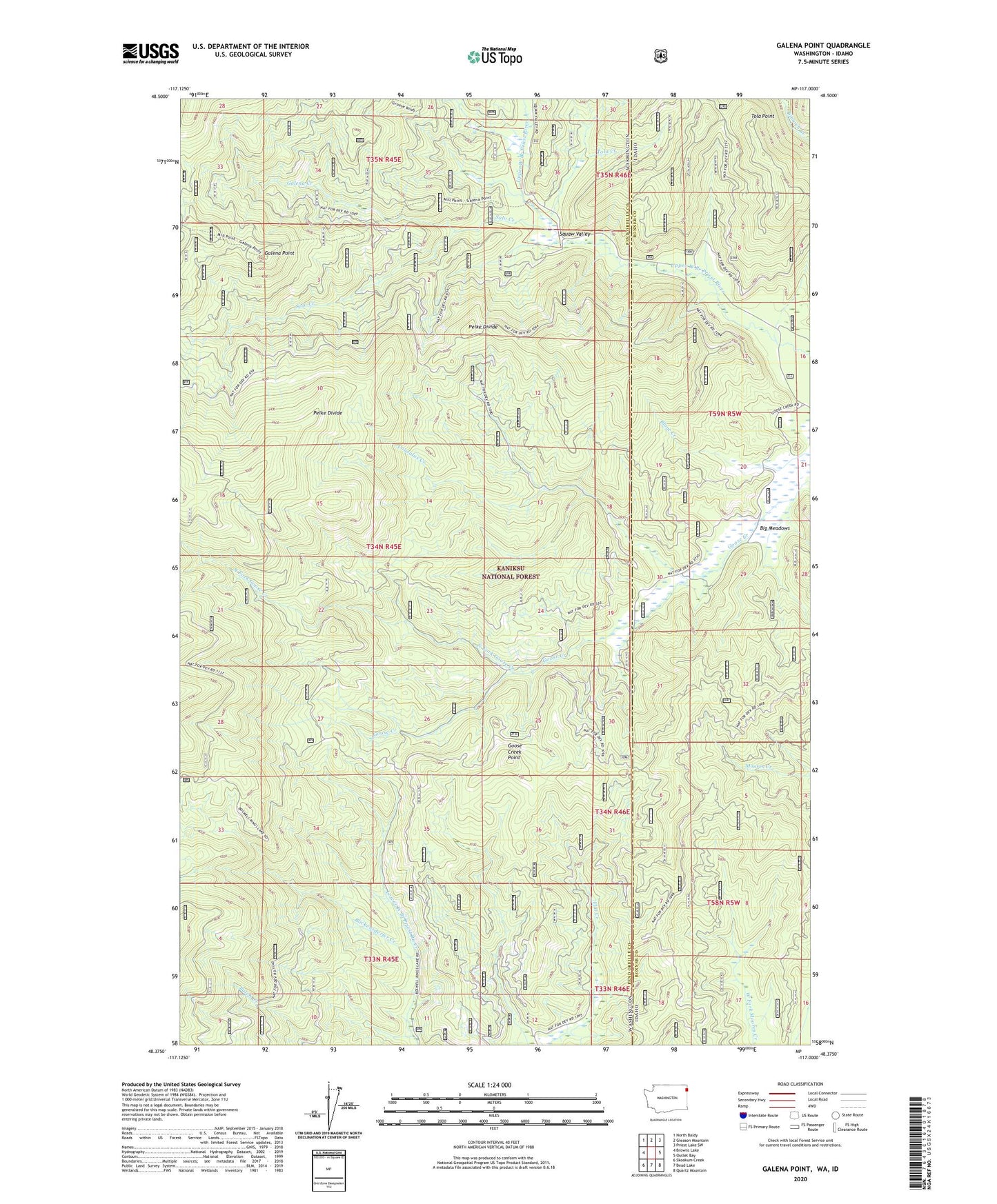
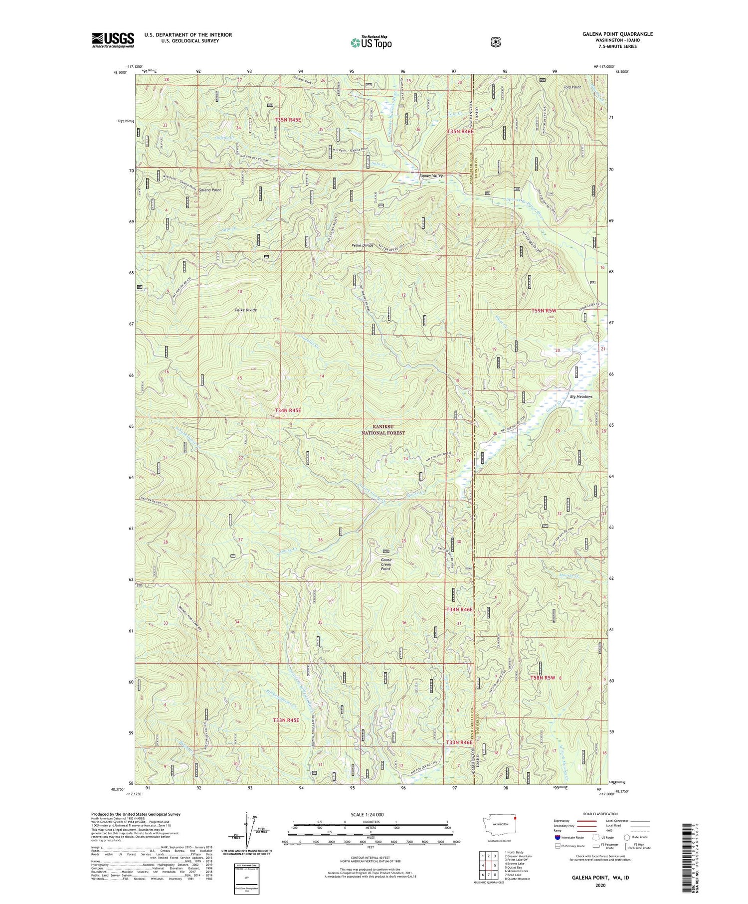
2020 topographic map quadrangle Galena Point in the states of Washington, Idaho. Scale: 1:24000. Based on the newly updated USGS 7.5' US Topo map series, this map is in the following counties: Pend Oreille, Bonner. The map contains contour data, water features, and other items you are used to seeing on USGS maps, but also has updated roads and other features. This is the next generation of topographic maps. Printed on high-quality waterproof paper with UV fade-resistant inks.
Quads adjacent to this one:
West: Browns Lake
Northwest: North Baldy
North: Gleason Mountain
Northeast: Priest Lake SW
East: Outlet Bay
Southeast: Quartz Mountain
South: Bead Lake
Southwest: Skookum Creek
Contains the following named places: Big Meadows, Blickensderfer Creek, Consalus Creek, Galena Creek, Galena Point, Goose Creek Lookout, Goose Creek Point, North Fork Goose Creek, Pelke Lookout, Solo Creek, Squaw Valley, Tola Creek, Tola Point