MyTopo
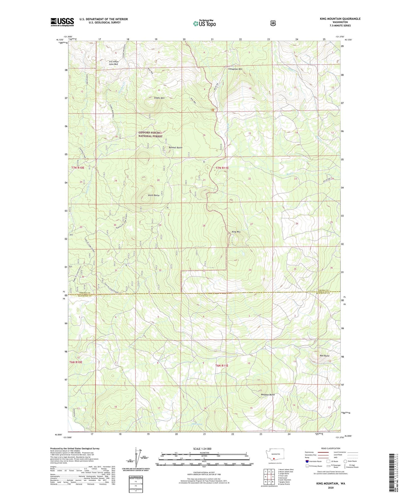
King Mountain Washington US Topo Map
Couldn't load pickup availability
Also explore the King Mountain Forest Service Topo of this same quad for updated USFS data
2023 topographic map quadrangle King Mountain in the state of Washington. Scale: 1:24000. Based on the newly updated USGS 7.5' US Topo map series, this map is in the following counties: Yakima, Klickitat. The map contains contour data, water features, and other items you are used to seeing on USGS maps, but also has updated roads and other features. This is the next generation of topographic maps. Printed on high-quality waterproof paper with UV fade-resistant inks.
Quads adjacent to this one:
West: Trout Lake
Northwest: Mount Adams West
North: Mount Adams East
Northeast: Jungle Butte
East: Glenwood
Southeast: Camas Prairie
South: Quigley Butte
Southwest: Guler Mountain
This map covers the same area as the classic USGS quad with code o46121a4.
Contains the following named places: A G Aiken Lava Bed, Bunnell Butte, Gotchen Creek Guard Station, Island Campground, King Mountain, Meadow Butte, Mud Spring, Red Butte, Smith Butte, Snipes Mountain, Snowplow Mountain