MyTopo
Quigley Butte Washington US Topo Map
Couldn't load pickup availability
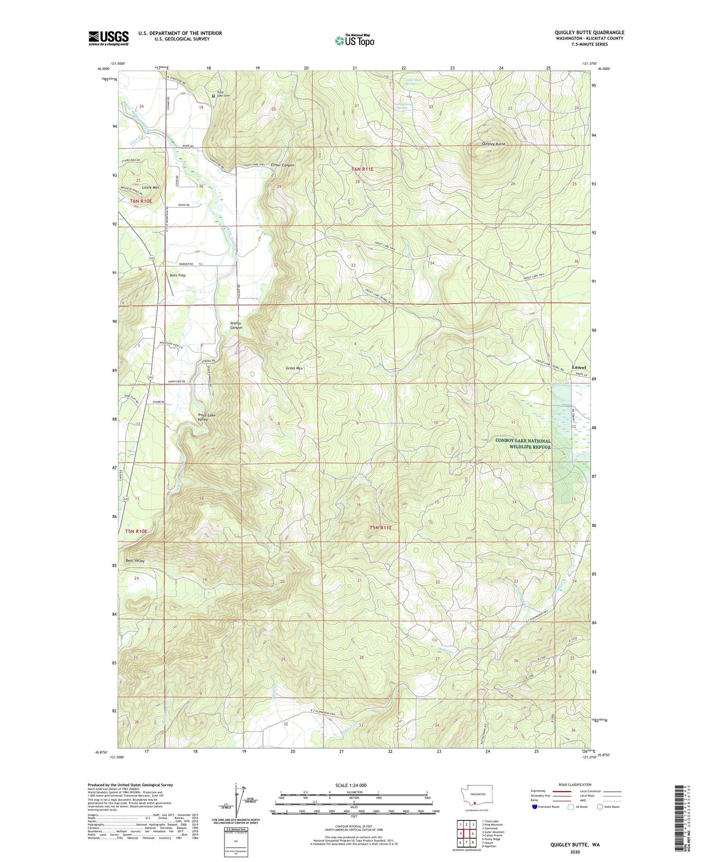
2023 topographic map quadrangle Quigley Butte in the state of Washington. Scale: 1:24000. Based on the newly updated USGS 7.5' US Topo map series, this map is in the following counties: Klickitat. The map contains contour data, water features, and other items you are used to seeing on USGS maps, but also has updated roads and other features. This is the next generation of topographic maps. Printed on high-quality waterproof paper with UV fade-resistant inks.
Quads adjacent to this one:
West: Guler Mountain
Northwest: Trout Lake
North: King Mountain
Northeast: Glenwood
East: Camas Prairie
Southeast: Appleton
South: Husum
Southwest: Penny Ridge
This map covers the same area as the classic USGS quad with code o45121h4.
Contains the following named places: Bob's Field, Chapman Spring, Elmer Canyon, Gross Mountain, Laurel, Little Mountain, Little Mud Springs, Quigley Butte, Stoller Canyon, Trout Lake Cemetery, Trout Lake Valley