MyTopo
Larch Mountain Washington US Topo Map
Couldn't load pickup availability
Also explore the Larch Mountain Forest Service Topo of this same quad for updated USFS data
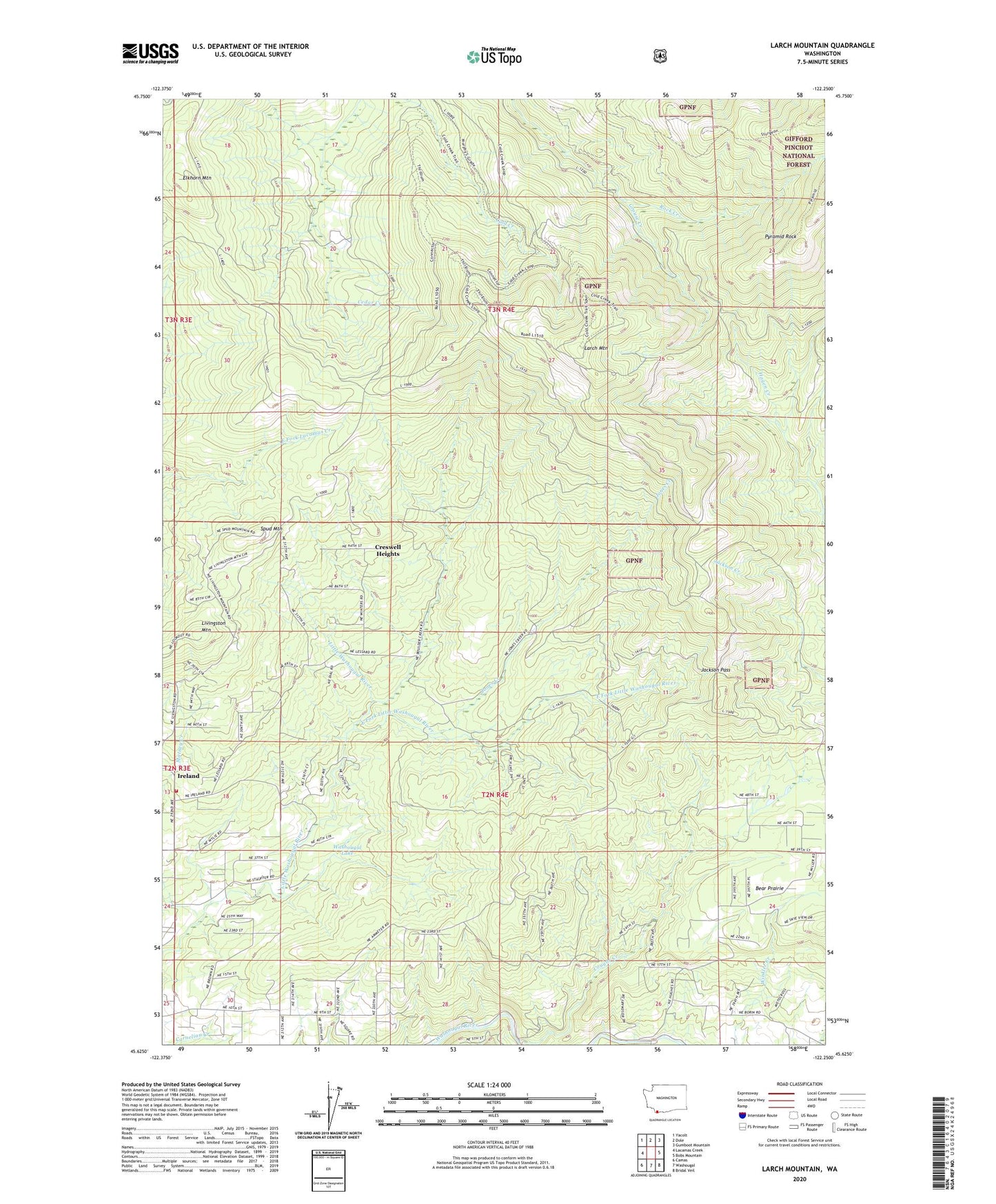
2023 topographic map quadrangle Larch Mountain in the state of Washington. Scale: 1:24000. Based on the newly updated USGS 7.5' US Topo map series, this map is in the following counties: Clark. The map contains contour data, water features, and other items you are used to seeing on USGS maps, but also has updated roads and other features. This is the next generation of topographic maps. Printed on high-quality waterproof paper with UV fade-resistant inks.
Quads adjacent to this one:
West: Lacamas Creek
Northwest: Yacolt
North: Dole
Northeast: Gumboot Mountain
East: Bobs Mountain
Southeast: Bridal Veil
South: Washougal
Southwest: Camas
This map covers the same area as the classic USGS quad with code o45122f3.
Contains the following named places: Camas Division, Cougar Creek, Creswell Heights, East County Fire and Rescue Station 92, East Fork Little Washougal River, Elkhorn Mountain, Grouse Creek, Grouse Creek Vista, Grouse Vista Picnic Site, Ireland, Jackson Pass, Jones Creek, Jones Creek Campground, Larch Corrections Center, Larch Mountain, Larch Mountain Picnic Site, Livingston Mountain, Pyramid Rock, Silver Star Mine, Spud Mountain, Sunnyside, Sunnyside School, Washougal Lake