MyTopo
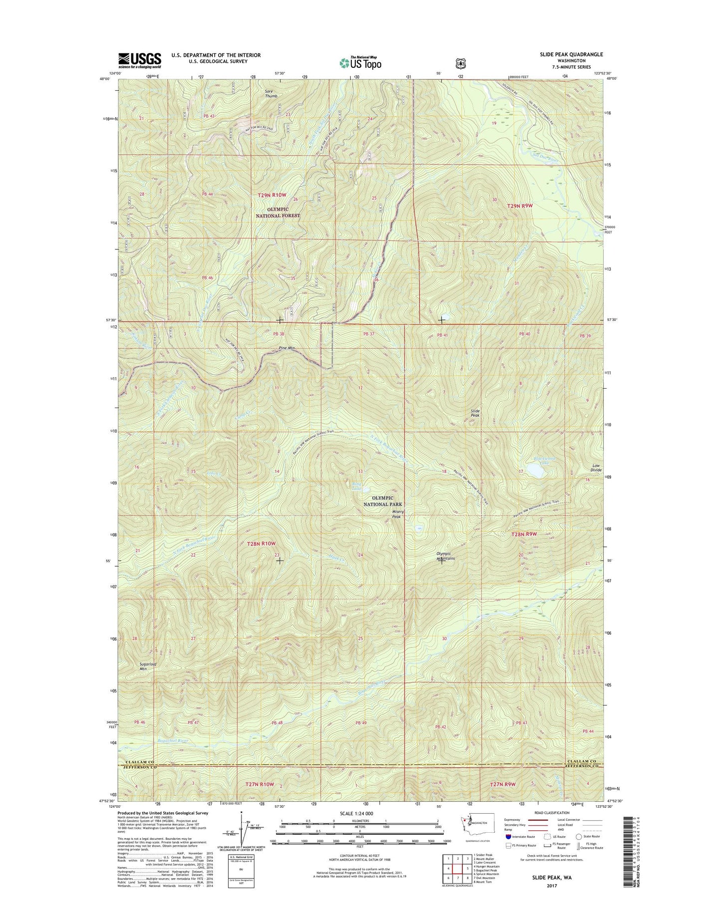
Slide Peak Washington US Topo Map
Couldn't load pickup availability
Also explore the Slide Peak Forest Service Topo of this same quad for updated USFS data
2023 topographic map quadrangle Slide Peak in the state of Washington. Scale: 1:24000. Based on the newly updated USGS 7.5' US Topo map series, this map is in the following counties: Clallam, Jefferson. The map contains contour data, water features, and other items you are used to seeing on USGS maps, but also has updated roads and other features. This is the next generation of topographic maps. Printed on high-quality waterproof paper with UV fade-resistant inks.
Quads adjacent to this one:
West: Hunger Mountain
Northwest: Snider Peak
North: Mount Muller
Northeast: Lake Crescent
East: Bogachiel Peak
Southeast: Mount Tom
South: Owl Mountain
Southwest: Spruce Mountain
This map covers the same area as the classic USGS quad with code o47123h8.
Contains the following named places: Alckee Creek, Blackwood Creek, Blackwood Lake, Bogachiel Trail, Camp Creek, Hyak Creek, Hyak Shelter, Lolo Creek, Low Divide, Misery Peak, Munden Creek, Pine Mountain, Ring Lake, Slide Peak, Sore Thumb, Sugarloaf Mountain, Twentyone Mile Shelter