MyTopo
Logan Hill Washington US Topo Map
Couldn't load pickup availability
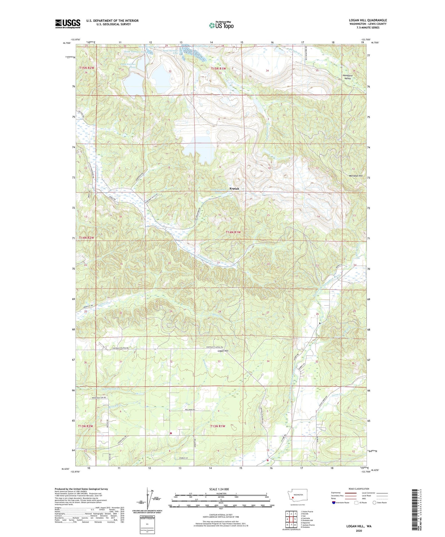
2023 topographic map quadrangle Logan Hill in the state of Washington. Scale: 1:24000. Based on the newly updated USGS 7.5' US Topo map series, this map is in the following counties: Lewis. The map contains contour data, water features, and other items you are used to seeing on USGS maps, but also has updated roads and other features. This is the next generation of topographic maps. Printed on high-quality waterproof paper with UV fade-resistant inks.
Quads adjacent to this one:
West: Centralia
Northwest: Violet Prairie
North: Bucoda
Northeast: Vail
East: Onalaska NW
Southeast: Onalaska
South: Jackson Prairie
Southwest: Napavine
This map covers the same area as the classic USGS quad with code o46122f7.
Contains the following named places: Bear Creek, Dam Number 1-A, Dam Number 3B, Dam Number Eight, Dam Number Five, Dam Number Four, Dam Number Seven, Dam Number Three, Dam Number Two, Hanaford, Kopiah, Lewis County Fire District 6 Logan Hill Station 63, Lewis County Fire District 6 Northfork Road Station 65, Logan Hill, Logan Hill Church, Logan Hill Division, Lucas Creek, Mendota, Meridian Hill, Mitchell Creek, Nulls Crossing, Pond Number 1-A, Pond Number Eight, Pond Number Five, Pond Number Four, Pond Number Seven, Pond Number Three, Pond Number Two