MyTopo
Onalaska NW Washington US Topo Map
Couldn't load pickup availability
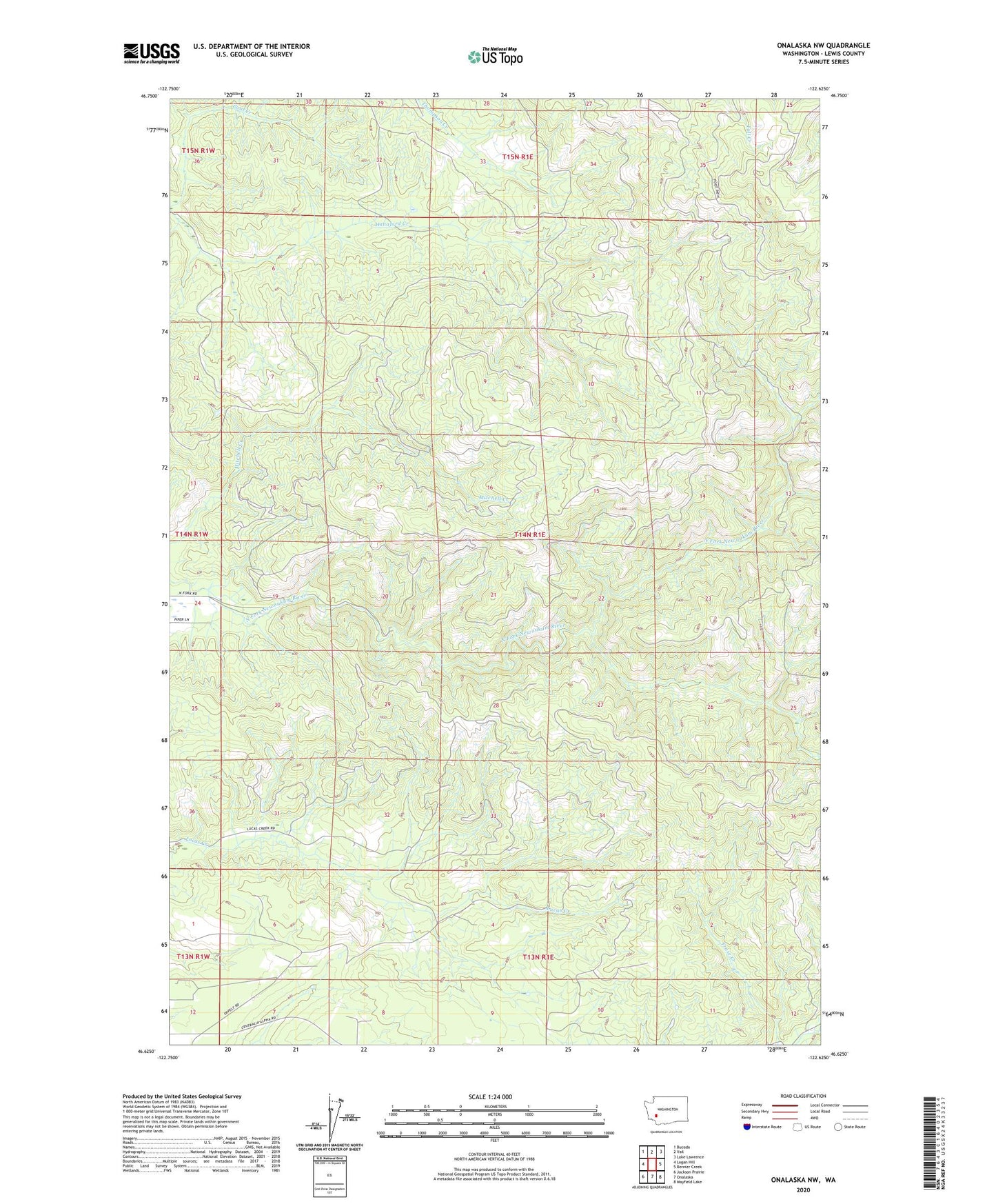
2023 topographic map quadrangle Onalaska NW in the state of Washington. Scale: 1:24000. Based on the newly updated USGS 7.5' US Topo map series, this map is in the following counties: Lewis. The map contains contour data, water features, and other items you are used to seeing on USGS maps, but also has updated roads and other features. This is the next generation of topographic maps. Printed on high-quality waterproof paper with UV fade-resistant inks.
Quads adjacent to this one:
West: Logan Hill
Northwest: Bucoda
North: Vail
Northeast: Lake Lawrence
East: Bernier Creek
Southeast: Mayfield Lake
South: Onalaska
Southwest: Jackson Prairie
This map covers the same area as the classic USGS quad with code o46122f6.
Contains the following named places: Coal Creek, Hunters Cabin Lookout, Lucas Creek Lookout, ZIP Code: 98570