MyTopo
Kiona Peak Washington US Topo Map
Couldn't load pickup availability
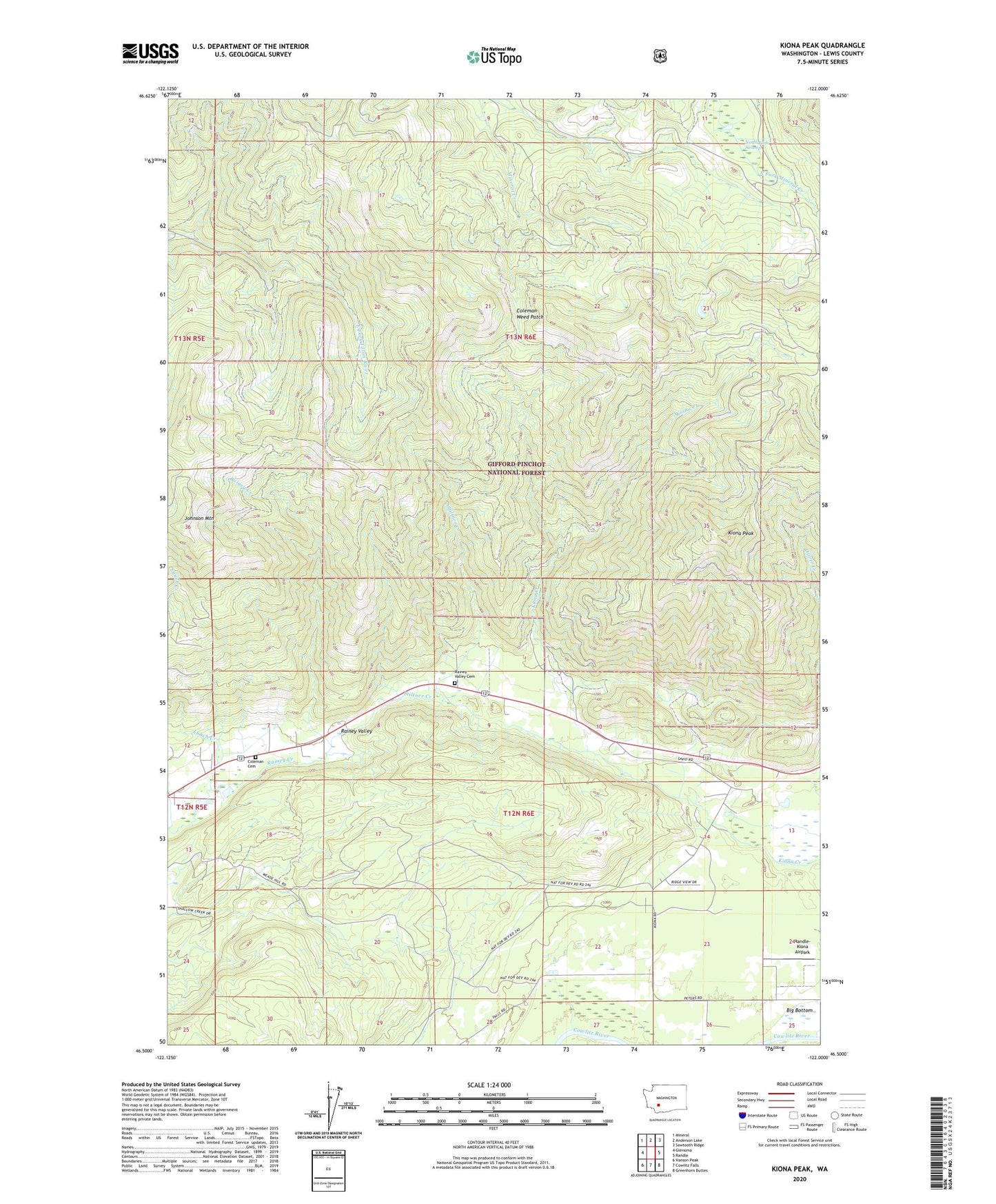
2020 topographic map quadrangle Kiona Peak in the state of Washington. Scale: 1:24000. Based on the newly updated USGS 7.5' US Topo map series, this map is in the following counties: Lewis. The map contains contour data, water features, and other items you are used to seeing on USGS maps, but also has updated roads and other features. This is the next generation of topographic maps. Printed on high-quality waterproof paper with UV fade-resistant inks.
Quads adjacent to this one:
West: Glenoma
Northwest: Mineral
North: Anderson Lake
Northeast: Sawtooth Ridge
East: Randle
Southeast: Greenhorn Buttes
South: Cowlitz Falls
Southwest: Vanson Peak
Contains the following named places: Coleman Cemetery, Coleman Weed Patch, Johnson Mountain, Kiona Peak, Lunch Creek, North Fork Swamp, Rainey Valley Cemetery, Randle-Kiona Airpark, Stiltner Creek, ZIP Code: 98336