MyTopo
Kittitas Washington US Topo Map
Couldn't load pickup availability
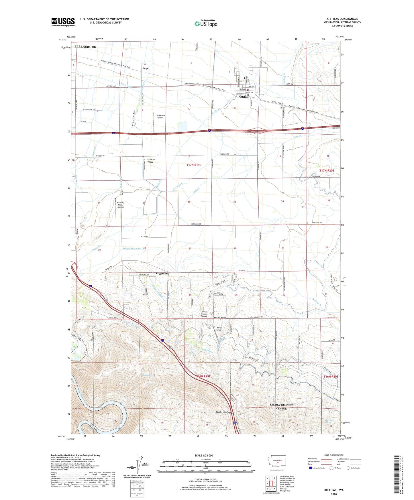
2020 topographic map quadrangle Kittitas in the state of Washington. Scale: 1:24000. Based on the newly updated USGS 7.5' US Topo map series, this map is in the following counties: Kittitas. The map contains contour data, water features, and other items you are used to seeing on USGS maps, but also has updated roads and other features. This is the next generation of topographic maps. Printed on high-quality waterproof paper with UV fade-resistant inks.
Quads adjacent to this one:
West: Ellensburg South
Northwest: Ellensburg North
North: Colockum Pass SW
Northeast: Colockum Pass SE
East: East Kittitas
Southeast: Badger Gap
South: Wymer
Southwest: The Cottonwoods
Contains the following named places: Badger Creek, Beiter Airport, Caribou Creek, Chinook Farms Airport, City of Kittitas, City of Kittitas Fire Department, Coleman Creek, Cooke Creek, Denmark Hall, Denmark School, Edgemont, Hillcrest Farms Airport, J K D Farms Airport, Kittitas, Kittitas B - 5 Special Education Program, Kittitas High School, Kittitas Police Department, Kittitas Post Office, KQBE-FM (Ellensburg), KXLE-FM (Ellensburg), Lost Spring, Old German Baptist Brethren Church Cemetery, Olmstead Place State Park, Park Creek, Regal, Sorenson Spring, Turbine Ditch, Vanderbilt Gap, Wipple Wasteway, ZIP Code: 98934