MyTopo
Twin Lakes Washington US Topo Map
Couldn't load pickup availability
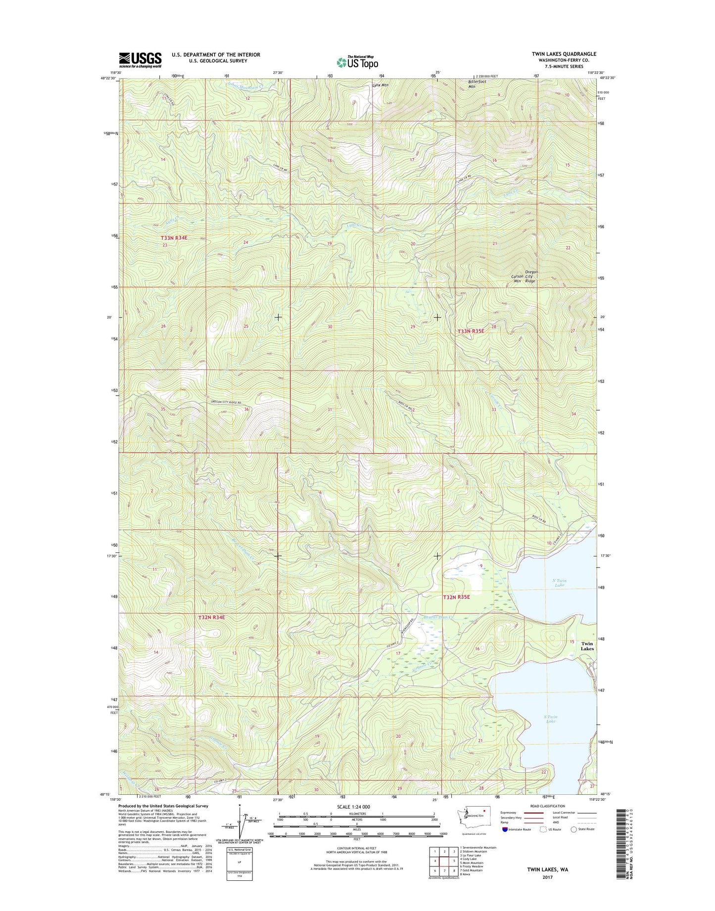
2023 topographic map quadrangle Twin Lakes in the state of Washington. Scale: 1:24000. Based on the newly updated USGS 7.5' US Topo map series, this map is in the following counties: Ferry. The map contains contour data, water features, and other items you are used to seeing on USGS maps, but also has updated roads and other features. This is the next generation of topographic maps. Printed on high-quality waterproof paper with UV fade-resistant inks.
Quads adjacent to this one:
West: Cody Lake
Northwest: Seventeenmile Mountain
North: Sitdown Mountain
Northeast: La Fleur Lake
East: Moon Mountain
Southeast: Kewa
South: Gold Mountain
Southwest: Frosty Meadow
This map covers the same area as the classic USGS quad with code o48118c4.
Contains the following named places: Beaver Dam Creek, Carson Creek, Carson Mountain, Colville Tribal Emergency Medical Services, Granite Creek, Log Cabin Resort Mobile Home Park, North Twin Lake, Oregon City Ridge, Rocky Point Campground, South Twin Lake, Twin Lakes, Twin Lakes Reservoir