MyTopo
Lyle Washington US Topo Map
Couldn't load pickup availability
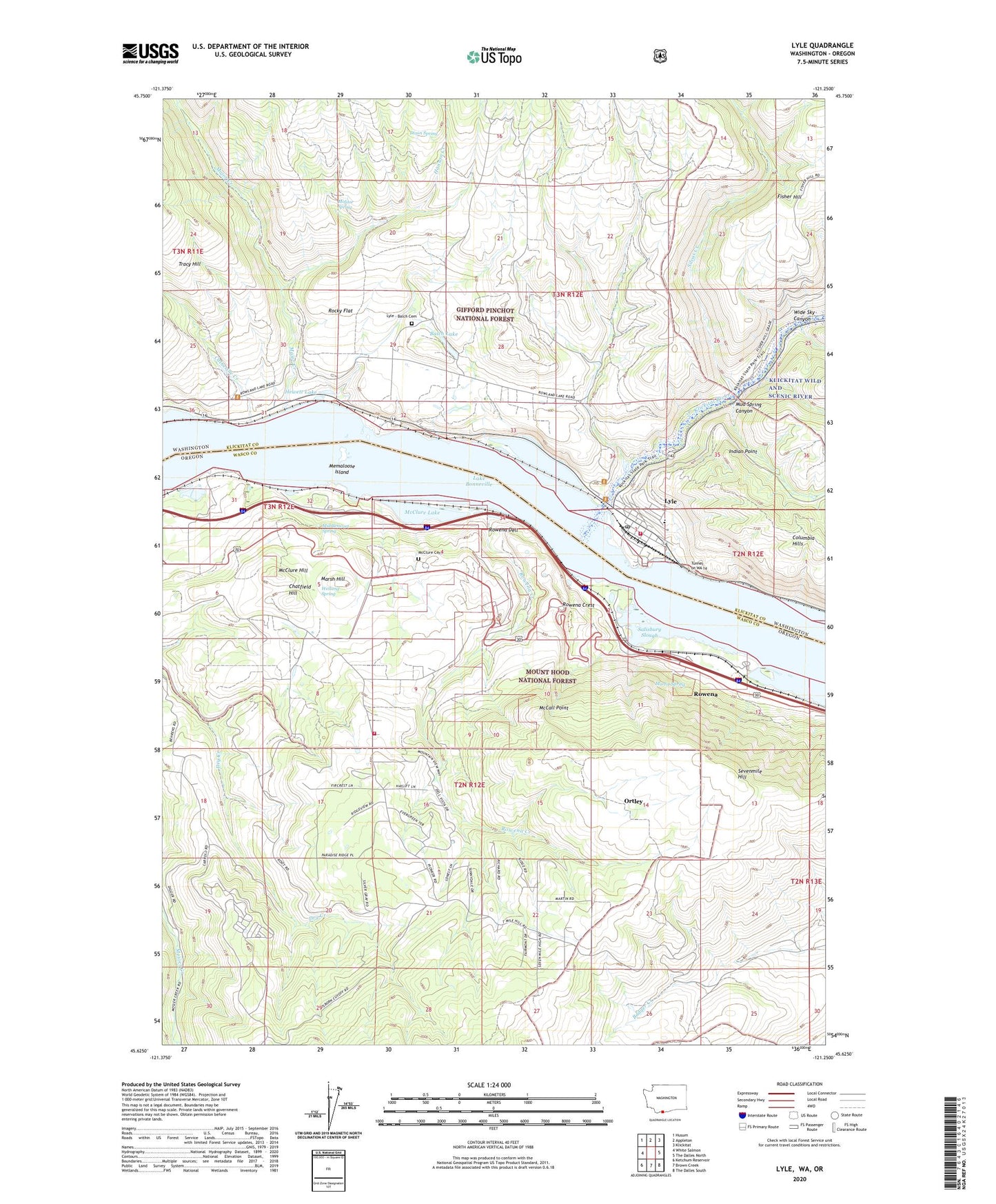
2020 topographic map quadrangle Lyle in the states of Oregon, Washington. Scale: 1:24000. Based on the newly updated USGS 7.5' US Topo map series, this map is in the following counties: Klickitat, Wasco. The map contains contour data, water features, and other items you are used to seeing on USGS maps, but also has updated roads and other features. This is the next generation of topographic maps. Printed on high-quality waterproof paper with UV fade-resistant inks.
Quads adjacent to this one:
West: White Salmon
Northwest: Husum
North: Appleton
Northeast: Klickitat
East: The Dalles North
Southeast: The Dalles South
South: Brown Creek
Southwest: Ketchum Reservoir
Contains the following named places: Balch Lake, Catherine Creek, Chamberlain Lake, Chatfield, Chatfield Hill, Dixon Spring, Hanson Creek, Hewett Lake, Indian Point, Klickitat County Fire District 4, Klickitat River, Lyle, Lyle - Balch Cemetery, Lyle Census Designated Place, Lyle High School, Lyle Post Office, Lyle Treaty Fishing Access Site, Major Creek, Marsh Hill, Martin Spring, Mayer State Park, Mayer State Park Boat Ramp, McCall Point, McClure Cemetery, McClure Hill, McClure Lake, Memaloose Island, Memaloose Overlook, Memaloose Safety Rest Area, Memaloose State Park, Middleswart Spring, Molitor Spring, Mosier Rural Fire District Station 2, Mud Spring Canyon, Ortley, Ortley Post Office, Rocky Flat, Rowena, Rowena Census Designated Place, Rowena Creek, Rowena Crest, Rowena Dell, Rowena Dell Airstrip, Rowena Post Office, Salisbury Slough, Sevenmile Hill, Silvas Creek, Tunnel on WA 14, Wetland Spring, Wide Sky Canyon