MyTopo
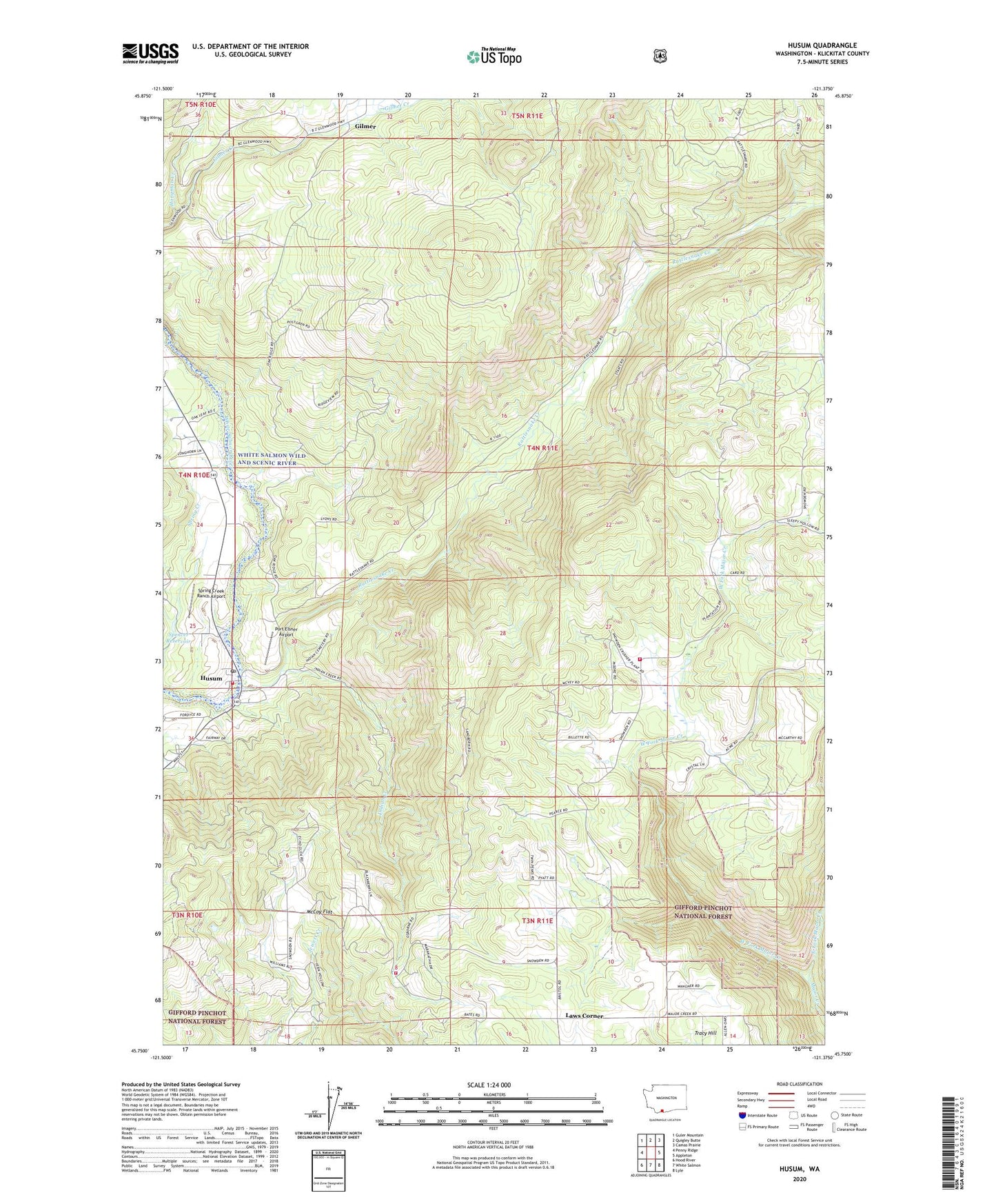
Husum Washington US Topo Map
Couldn't load pickup availability
Also explore the Husum Forest Service Topo of this same quad for updated USFS data
2023 topographic map quadrangle Husum in the state of Washington. Scale: 1:24000. Based on the newly updated USGS 7.5' US Topo map series, this map is in the following counties: Klickitat. The map contains contour data, water features, and other items you are used to seeing on USGS maps, but also has updated roads and other features. This is the next generation of topographic maps. Printed on high-quality waterproof paper with UV fade-resistant inks.
Quads adjacent to this one:
West: Penny Ridge
Northwest: Guler Mountain
North: Quigley Butte
Northeast: Camas Prairie
East: Appleton
Southeast: Lyle
South: White Salmon
Southwest: Hood River
This map covers the same area as the classic USGS quad with code o45121g4.
Contains the following named places: East Fork Major Creek, Gilmer, Hangman Creek, Husum, Husum Post Office, Indian Creek, Klickitat County Fire District 3, Klickitat County Fire District 3 Mountain Brook, Klickitat County Fire Protection District 3 Husum, Kline Creek, Laws Corner, McCoy Flat, Mountain Brook, Mountain Brook School, Port Elsner Airport, Rattlesnake Creek, Spencer Reservoir, Spencer Reservoir Dam, Spring Creek Ranch Airport, Tracy Hill, West Fork Major Creek, White Salmon Division, ZIP Code: 98672