MyTopo
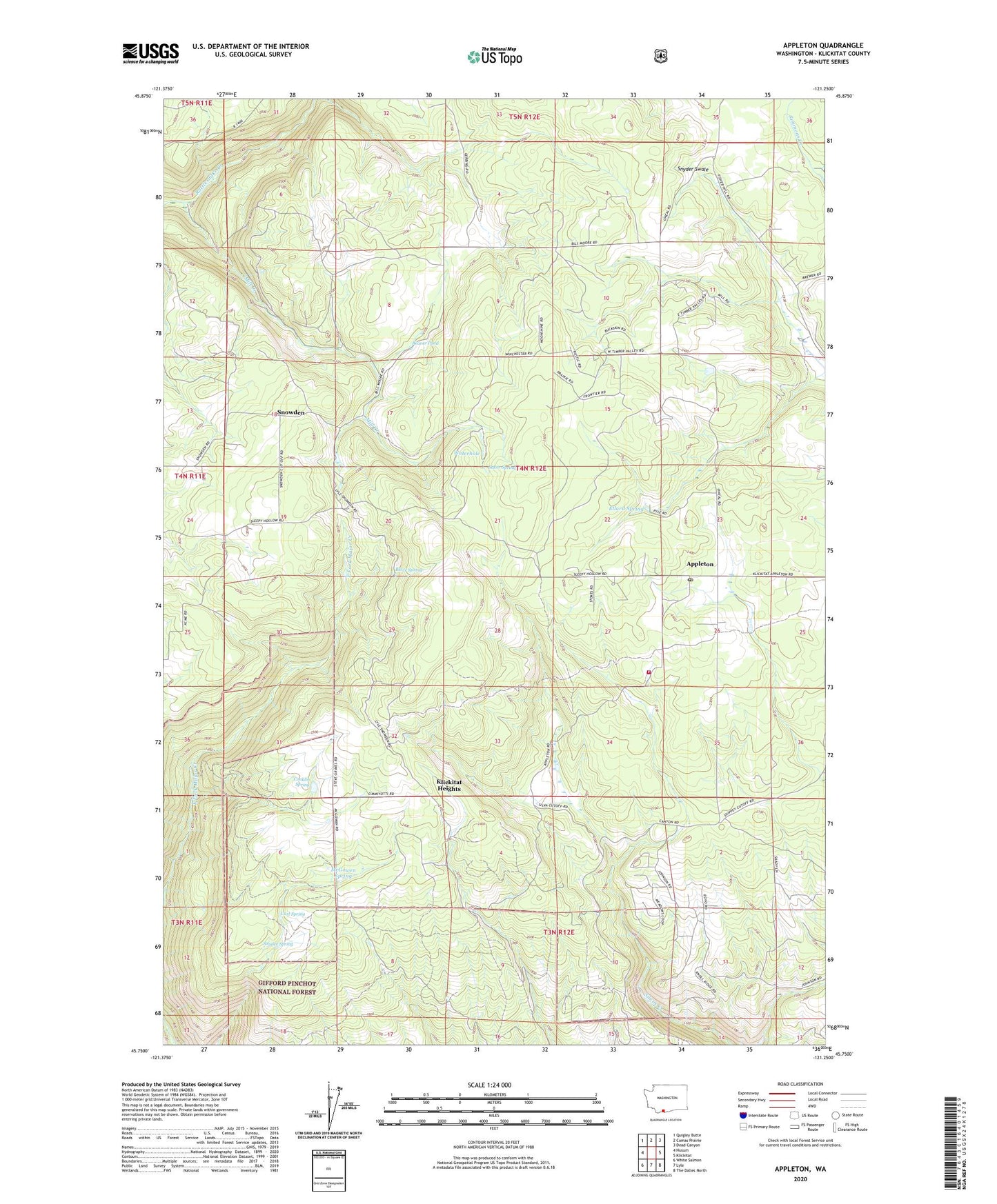
Appleton Washington US Topo Map
Couldn't load pickup availability
Also explore the Appleton Forest Service Topo of this same quad for updated USFS data
2023 topographic map quadrangle Appleton in the state of Washington. Scale: 1:24000. Based on the newly updated USGS 7.5' US Topo map series, this map is in the following counties: Klickitat. The map contains contour data, water features, and other items you are used to seeing on USGS maps, but also has updated roads and other features. This is the next generation of topographic maps. Printed on high-quality waterproof paper with UV fade-resistant inks.
Quads adjacent to this one:
West: Husum
Northwest: Quigley Butte
North: Camas Prairie
Northeast: Dead Canyon
East: Klickitat
Southeast: The Dalles North
South: Lyle
Southwest: White Salmon
This map covers the same area as the classic USGS quad with code o45121g3.
Contains the following named places: Appleton, Appleton Post Office, Baker Spring, Beaver Pond, Blove Spring, Conklin Spring, Curl Spring, Ellard Spring, Graves Dam, Klickitat County Fire District 13, Klickitat Heights, McGowen Spring, Mill Creek, Snowden, Snyder Spring, Snyder Swale, Waterhole, ZIP Code: 98602