MyTopo
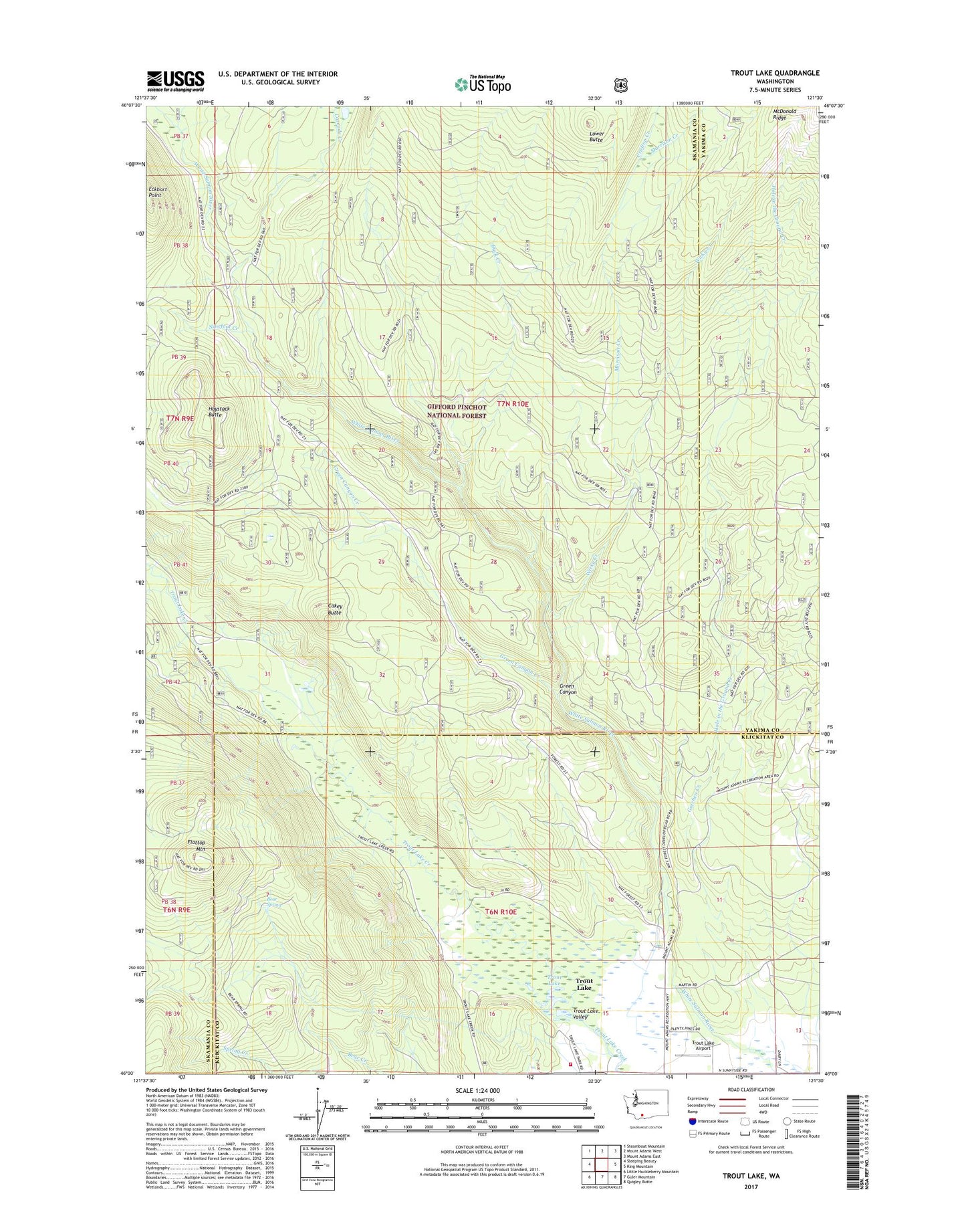
Trout Lake Washington US Topo Map
Couldn't load pickup availability
Also explore the Trout Lake Forest Service Topo of this same quad for updated USFS data
2023 topographic map quadrangle Trout Lake in the state of Washington. Scale: 1:24000. Based on the newly updated USGS 7.5' US Topo map series, this map is in the following counties: Skamania, Klickitat, Yakima. The map contains contour data, water features, and other items you are used to seeing on USGS maps, but also has updated roads and other features. This is the next generation of topographic maps. Printed on high-quality waterproof paper with UV fade-resistant inks.
Quads adjacent to this one:
West: Sleeping Beauty
Northwest: Steamboat Mountain
North: Mount Adams West
Northeast: Mount Adams East
East: King Mountain
Southeast: Quigley Butte
South: Guler Mountain
Southwest: Little Huckleberry Mountain
This map covers the same area as the classic USGS quad with code o46121a5.
Contains the following named places: Bear Spring, Buck Creek, Cakey Butte, Cascade Creek, Crofton Creek, East Flattop Lookout, Eckhart Point, Flattop Mountain, Gotchen Creek, Green Canyon, Green Canyon Creek, Haystack Butte, Hole in the Ground Creek, Hollenbeck Landing Strip, Klickitat County Fire District 1, Lower Butte, Morrison Creek, Morrison Creek Horse Camp, Mount Adams Forest Camp, Ninefoot Creek, Trout Lake, Trout Lake Airport, Trout Lake Big Tree, Trout Lake Creek Campground, West Flattop Lookout, White Salmon Wild and Scenic River, Wicky Creek, Wicky Creek Shelter