MyTopo
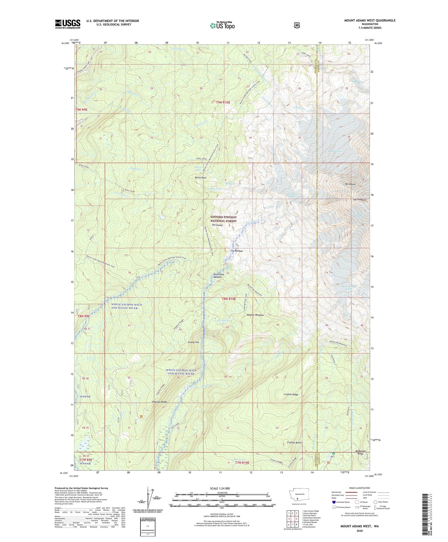
Mount Adams West Washington US Topo Map
Couldn't load pickup availability
2020 topographic map quadrangle Mount Adams West in the state of Washington. Scale: 1:24000. Based on the newly updated USGS 7.5' US Topo map series, this map is in the following counties: Skamania, Yakima. The map contains contour data, water features, and other items you are used to seeing on USGS maps, but also has updated roads and other features. This is the next generation of topographic maps. Printed on high-quality waterproof paper with UV fade-resistant inks.
Quads adjacent to this one:
West: Steamboat Mountain
Northwest: East Canyon Ridge
North: Green Mountain
Northeast: Glaciate Butte
East: Mount Adams East
Southeast: King Mountain
South: Trout Lake
Southwest: Sleeping Beauty
Contains the following named places: Adams Glacier, Avalanche Glacier, Bottle Camp, Burnt Rock, Crofton Butte, Crofton Ridge, Crystal Lake, Divide Camp, Dry Lake Camp, Grassy Hill, Graveyard Camp, High Camp, Horseshoe Meadow, Lake Camp, Lookingglass Lake, Madcat Meadow, Meadow Camp, Morrison Creek Campground, Mount Adams Wilderness, Mutton Creek, Pinnacle Glacier, Riley Camp, Rock Spring, Round the Mountain Trail, Salt Creek, Sheep Lake, Shorthorn Creek, Sled Camp, Stagman Ridge, The Bumper, The Hump, The Pinnacle, White Salmon Glacier