MyTopo
Mount Baker Washington US Topo Map
Couldn't load pickup availability
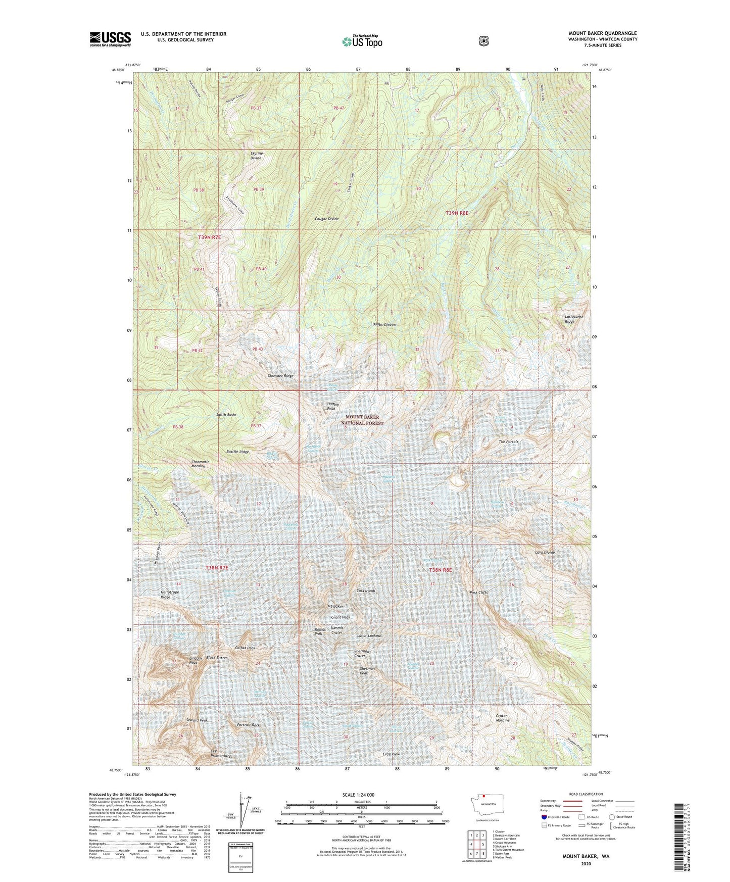
2020 topographic map quadrangle Mount Baker in the state of Washington. Scale: 1:24000. Based on the newly updated USGS 7.5' US Topo map series, this map is in the following counties: Whatcom. The map contains contour data, water features, and other items you are used to seeing on USGS maps, but also has updated roads and other features. This is the next generation of topographic maps. Printed on high-quality waterproof paper with UV fade-resistant inks.
Quads adjacent to this one:
West: Groat Mountain
Northwest: Glacier
North: Bearpaw Mountain
Northeast: Mount Larrabee
East: Shuksan Arm
Southeast: Welker Peak
South: Baker Pass
Southwest: Twin Sisters Mountain
Contains the following named places: Bar Creek, Bastile Glacier, Bastile Ridge, Black Buttes, Boulder Glacier, Chowder Ridge, Chromatic Moraine, Cockscomb, Coleman Glacier, Colfax Peak, Cougar Divide, Crater Moraine, Deming Glacier, Dobbs Cleaver, Dobbs Creek, Dorr Fumarole Field, Easton Glacier, Grant Peak, Hadley Glacier, Hadley Peak, Heliotrope Ridge, Kulshan Cabin, Lahar Lookout, Lasiocarpa Ridge, Lava Divide, Lee Promontory, Lincoln Peak, Mazama Glacier, Mount Baker, No Name Glacier, Park Cliffs, Park Glacier, Portrait Rock, Rainbow Glacier, Roman Wall, Roosevelt Glacier, Seward Peak, Sherman Crater, Sherman Peak, Sholes Creek, Sholes Glacier, Skyline Divide, Smith Basin, Squak Glacier, Summit Crater, Talum Glaciers, The Portals, Thunder Glacier, Whatcom County