MyTopo
Twin Sisters Mountain Washington US Topo Map
Couldn't load pickup availability
Also explore the Twin Sisters Mountain Forest Service Topo of this same quad for updated USFS data
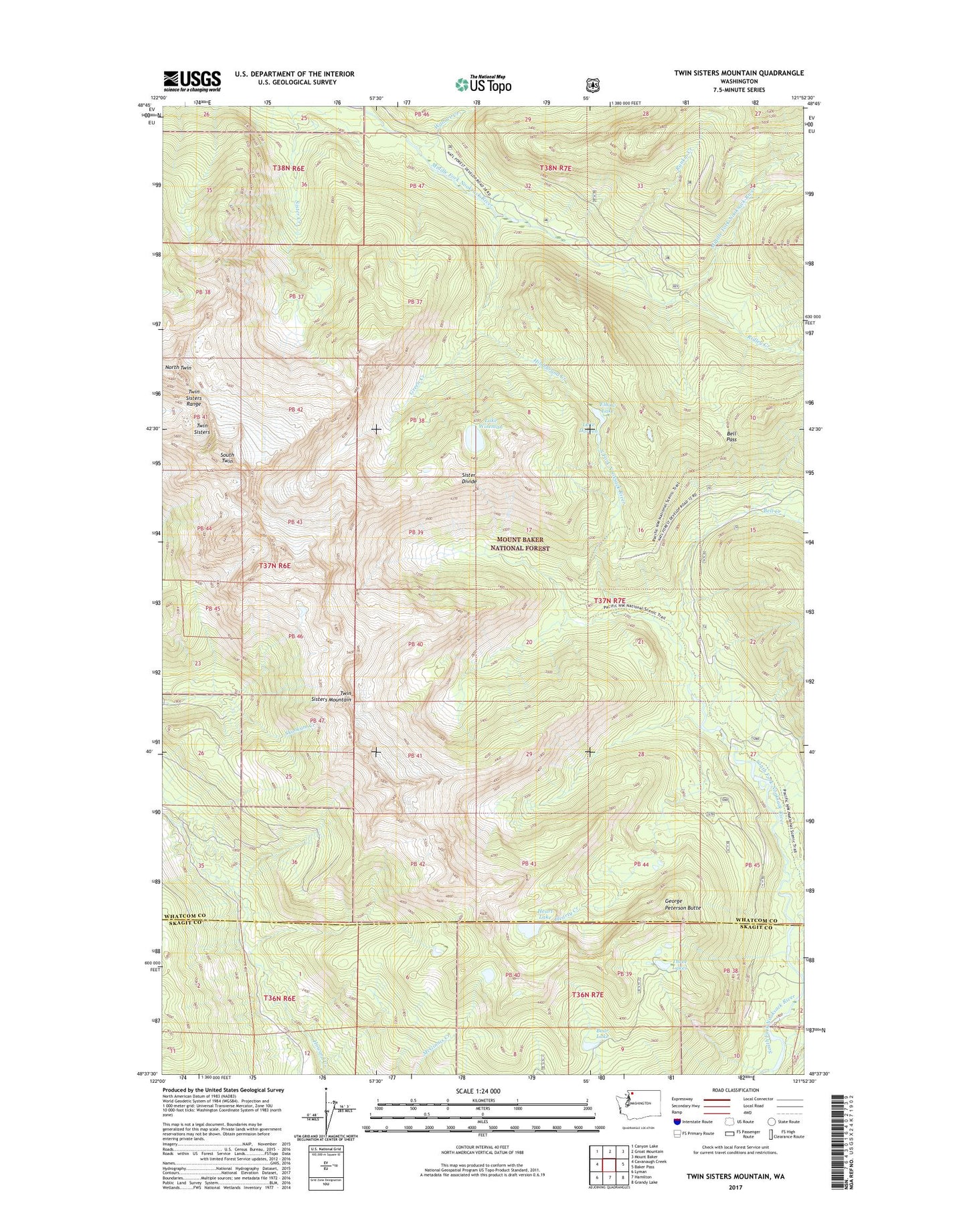
2023 topographic map quadrangle Twin Sisters Mountain in the state of Washington. Scale: 1:24000. Based on the newly updated USGS 7.5' US Topo map series, this map is in the following counties: Whatcom, Skagit. The map contains contour data, water features, and other items you are used to seeing on USGS maps, but also has updated roads and other features. This is the next generation of topographic maps. Printed on high-quality waterproof paper with UV fade-resistant inks.
Quads adjacent to this one:
West: Cavanaugh Creek
Northwest: Canyon Lake
North: Groat Mountain
Northeast: Mount Baker
East: Baker Pass
Southeast: Grandy Lake
South: Hamilton
Southwest: Lyman
This map covers the same area as the classic USGS quad with code o48121f8.
Contains the following named places: Bear Lake, Bell Creek, Bell Pass, Elbow Lake, George Peterson Butte, Green Creek, Heart Lake, Hearty Creek, Hildebrand Creek, Lake Doreen, Lake Hildebrand, Lake Wiseman, North Twin, Rankin Creek, Ridley Creek, Sister Divide, South Twin, Three Lakes, Twin Sisters Mountain, Wallace Creek, Wanlick Creek