MyTopo
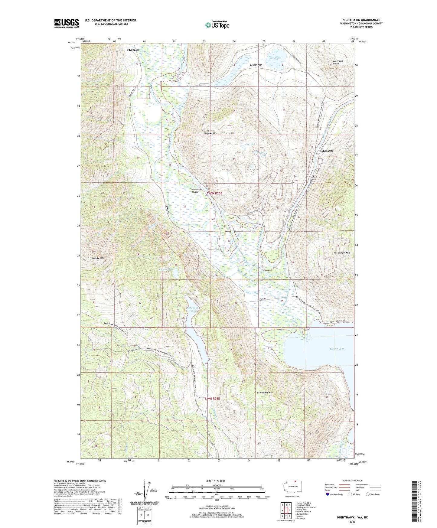
Nighthawk Washington US Topo Map
Couldn't load pickup availability
2023 topographic map quadrangle Nighthawk in the state of Washington. Scale: 1:24000. Based on the newly updated USGS 7.5' US Topo map series, this map is in the following counties: Okanogan. The map contains contour data, water features, and other items you are used to seeing on USGS maps, but also has updated roads and other features. This is the next generation of topographic maps. Printed on high-quality waterproof paper with UV fade-resistant inks.
Quads adjacent to this one:
West: Hurley Peak
Northwest: Hurley Peak OE N
North: Nighthawk OE N
Northeast: Bullfrog Mountain OE N
East: Bullfrog Mountain
Southeast: Enterprise
South: Loomis
Southwest: Duncan Ridge
This map covers the same area as the classic USGS quad with code o48119h6.
Contains the following named places: Alice Mine, Alkali flat, American Butte, Anderson Creek, Barber Mountain, Beef Pasture Cabin, Bowers Lake, Champneys Slough Stream, Chopaka, Chopaka Lake, Chopaka Lake Campground, Chopaka Valley, Edwards Slough, Favorite Mine, Four Metals Mine, Golden Zone Mine, Grandview Mountain, Hurley Creek, Jewett Creek, Juniper Point, Kabba Texas Mine, King Solomon Mine, Lenton Flat, Lenton Lake, Little Chopaka Mountain, Mountain Sheep Mine, Nighthawk, Nighthawk Customs, Nighthawk Mine, Olie Pass, Palmer Creek, Palmer Lake, Palmer Lake Campground, Prize Mine, Ruby Mine, Sheep Creek, Sinlahekin Creek, Sinlahekin Valley, Tenderfoot Mine, The Salt Lakes, Wyandotte Mine