MyTopo
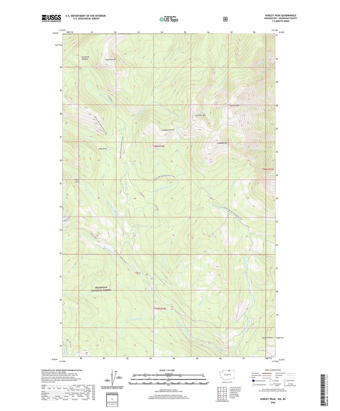
Hurley Peak Washington US Topo Map
Couldn't load pickup availability
Also explore the Hurley Peak Forest Service Topo of this same quad for updated USFS data
2023 topographic map quadrangle Hurley Peak in the state of Washington. Scale: 1:24000. Based on the newly updated USGS 7.5' US Topo map series, this map is in the following counties: Okanogan. The map contains contour data, water features, and other items you are used to seeing on USGS maps, but also has updated roads and other features. This is the next generation of topographic maps. Printed on high-quality waterproof paper with UV fade-resistant inks.
Quads adjacent to this one:
West: Horseshoe Basin
North: Hurley Peak OE N
Northeast: Nighthawk OE N
East: Nighthawk
Southeast: Loomis
South: Duncan Ridge
Southwest: Corral Butte
This map covers the same area as the classic USGS quad with code o48119h7.
Contains the following named places: Border Camp, Branch Creek, Chopaka Mountain, Chopaka Mountain Trail, Cold Creek, Cold Creek Camp, Corduroy Creek, Deer Park Creek, Disappointment, Disappointment Creek, Elevenmile Creek, Fourteen Mile Recreation Site, Fourteen Mile Trailhead, Goodenough Park, Hells Hole, Hurley Peak, Joe Mills Mountain, Johnny Bell Cabin, Juniper Point, Little Horseshoe Creek, Long Draw, North Fork Toats Creek Trail, Olallie Creek, Snehumption Creek, Snowshoe Creek, Snowshoe Meadow, Snowshoe Mountain, Stub Creek, Sunday Creek, Swamp Creek, Tenmile Creek, Twelvemile Creek