MyTopo
Onalaska Washington US Topo Map
Couldn't load pickup availability
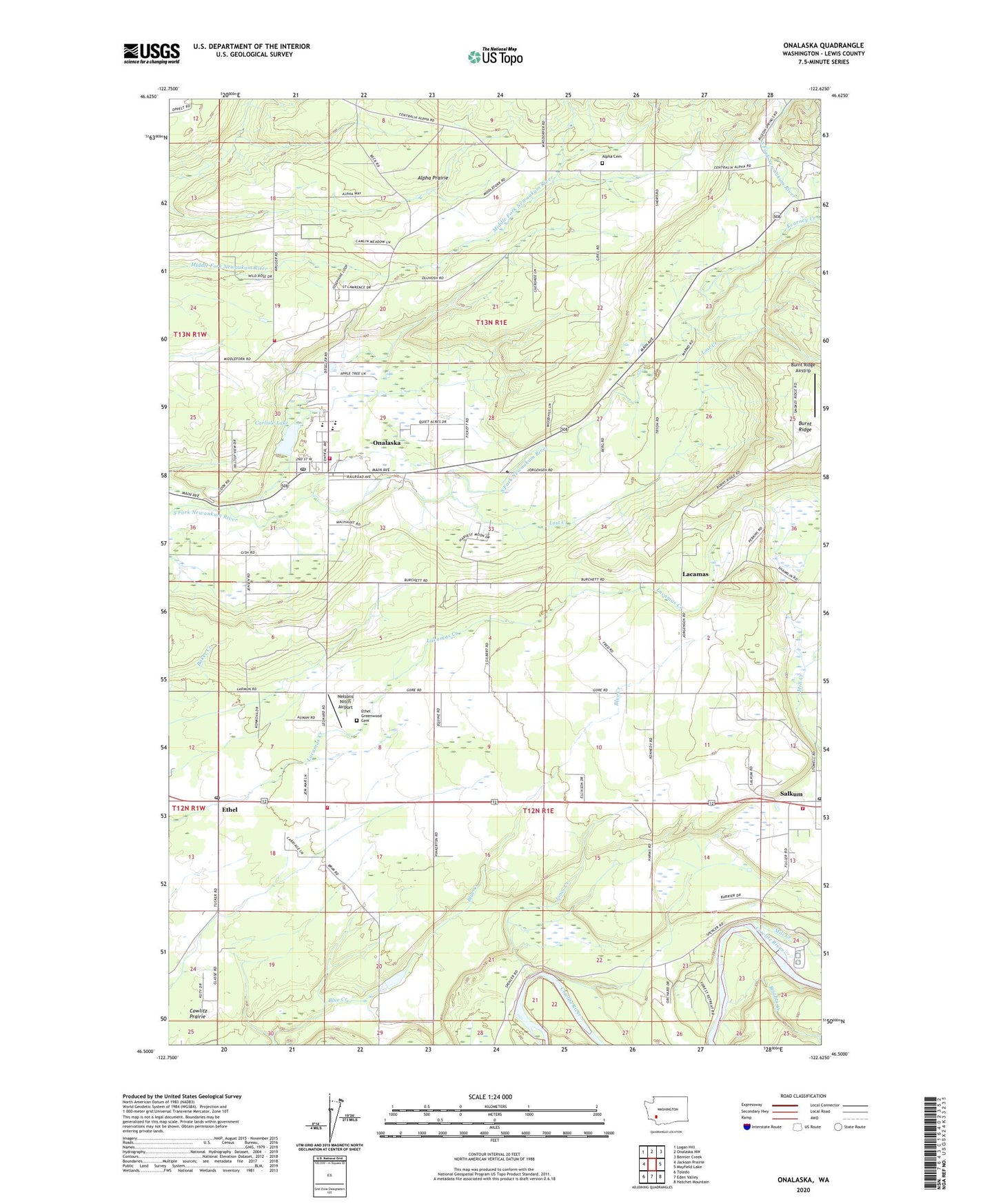
2020 topographic map quadrangle Onalaska in the state of Washington. Scale: 1:24000. Based on the newly updated USGS 7.5' US Topo map series, this map is in the following counties: Lewis. The map contains contour data, water features, and other items you are used to seeing on USGS maps, but also has updated roads and other features. This is the next generation of topographic maps. Printed on high-quality waterproof paper with UV fade-resistant inks.
Quads adjacent to this one:
West: Jackson Prairie
Northwest: Logan Hill
North: Onalaska NW
Northeast: Bernier Creek
East: Mayfield Lake
Southeast: Hatchet Mountain
South: Eden Valley
Southwest: Toledo
Contains the following named places: Alpha Cemetery, Alpha Prairie, Alpine Dairy, Brights Creek, Burnt Ridge, Burnt Ridge Airstrip, Carlisle Lake, Carlisle Lake Dam, Ethel, Ethel Division, Ethel Greenwood Cemetery, Ethel International Airport, Ethel Post Office, Frase Creek, Jones Creek, Kearney Creek, Lacamas, Lacamas Dairy, Lewis County Fire District 1 Station 1 - 1, Lewis County Fire District 1 Station 1 - 2, Lewis County Fire District 8 Salkum Volunteer Fire Department, Lewis County Fire District 8 Station 3, Lost Creek, Mill Creek, Misty Morning Dairy, Nelsons Nitch Airport, Onalaska, Onalaska Census Designated Place, Onalaska Elementary School, Onalaska High School, Onalaska Post Office, Phillips, Powell Dam, Salkum, Salkum Post Office, ZIP Code: 98582