MyTopo
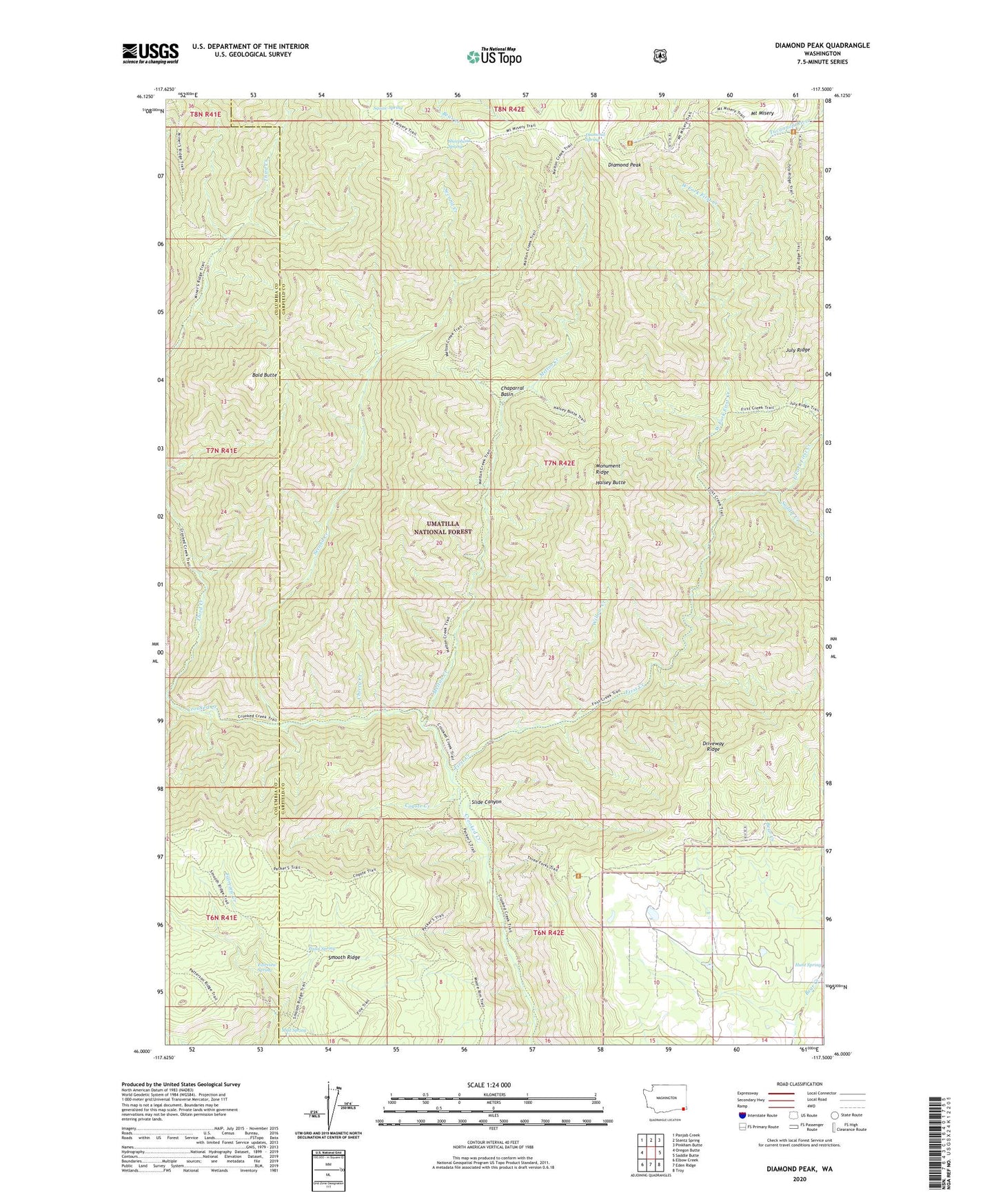
Diamond Peak Washington US Topo Map
Couldn't load pickup availability
Also explore the Diamond Peak Forest Service Topo of this same quad for updated USFS data
2023 topographic map quadrangle Diamond Peak in the state of Washington. Scale: 1:24000. Based on the newly updated USGS 7.5' US Topo map series, this map is in the following counties: Garfield, Columbia. The map contains contour data, water features, and other items you are used to seeing on USGS maps, but also has updated roads and other features. This is the next generation of topographic maps. Printed on high-quality waterproof paper with UV fade-resistant inks.
Quads adjacent to this one:
West: Oregon Butte
Northwest: Panjab Creek
North: Stentz Spring
Northeast: Pinkham Butte
East: Saddle Butte
Southeast: Troy
South: Eden Ridge
Southwest: Elbow Creek
This map covers the same area as the classic USGS quad with code o46117a5.
Contains the following named places: Bald Butte, C H Neal Ranch, Cecil Bott Ranch, Chaparral Basin, Cherry Creek, Coyote Creek, Crooked Creek Trail, Diamond Peak, Diamond Spring, East Fork First Creek, F Kessler Ranch, Fairview Spring, First Creek, First Creek Cabin, Halsey Butte, Hunt School, J R Evans Ranch, July Ridge, July Ridge Trail, Kelly Camp, Melton Creek, Melton Creek Trail, Monument Ridge, Mount Misery, Mud Spring, Packer Trail, Pistol Spring, Saddle Creek, Second Creek, Sheephead Corral, Sheephead Spring, Slide Canyon, Smooth Ridge, Squaw Spring, Third Creek, West Fork First Creek, Willow Creek