MyTopo
Penny Ridge Washington US Topo Map
Couldn't load pickup availability
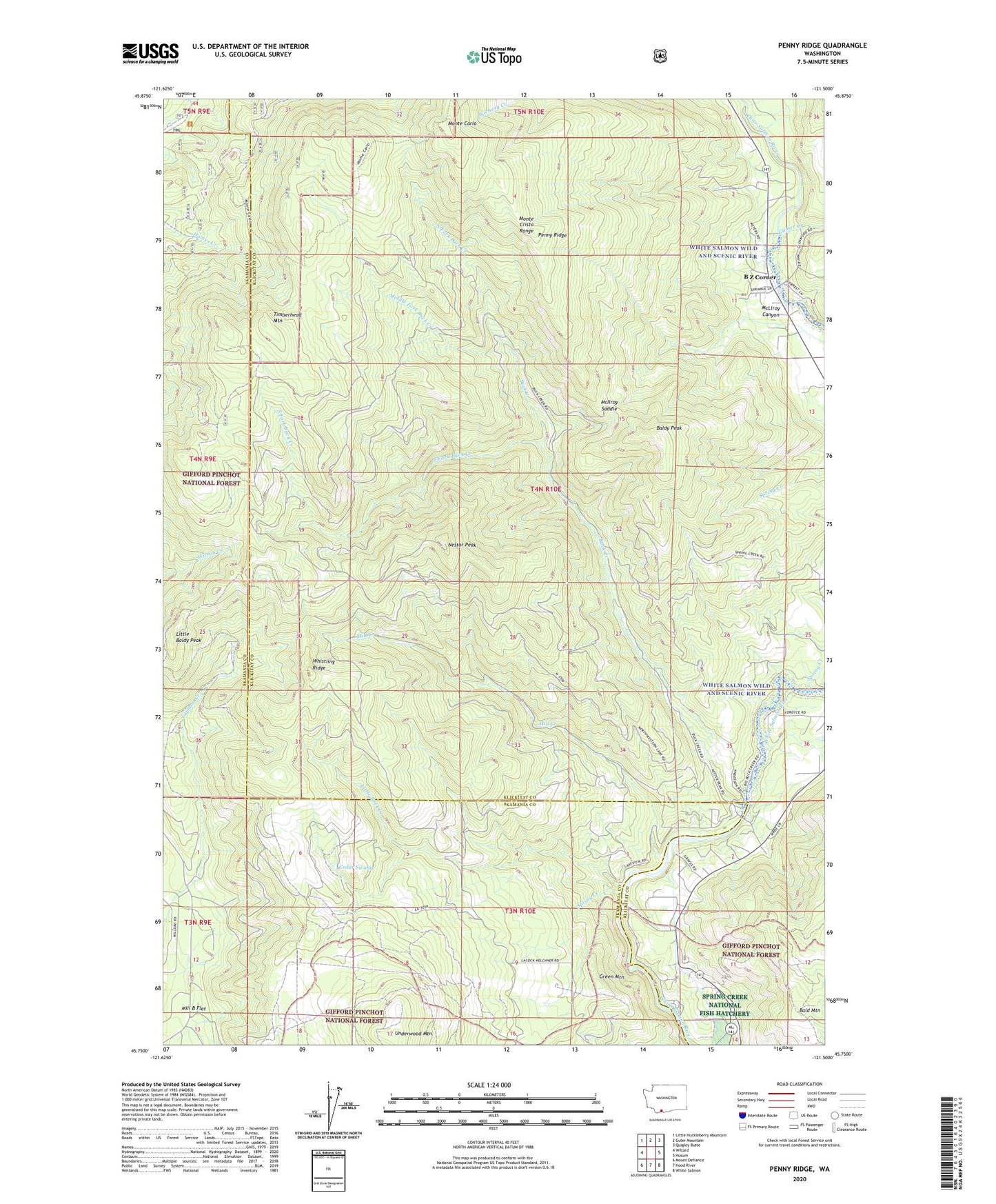
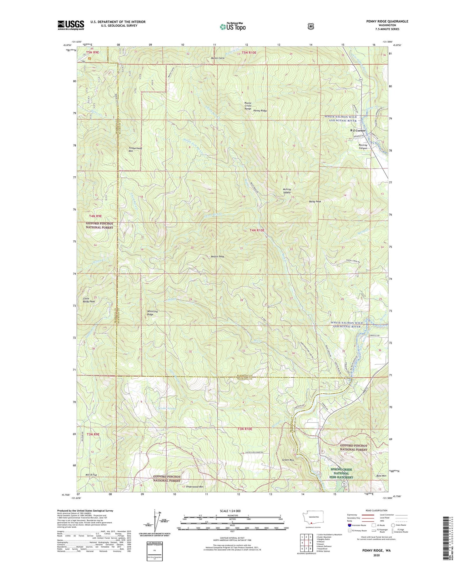
2020 topographic map quadrangle Penny Ridge in the state of Washington. Scale: 1:24000. Based on the newly updated USGS 7.5' US Topo map series, this map is in the following counties: Klickitat, Skamania. The map contains contour data, water features, and other items you are used to seeing on USGS maps, but also has updated roads and other features. This is the next generation of topographic maps. Printed on high-quality waterproof paper with UV fade-resistant inks.
Quads adjacent to this one:
West: Willard
Northwest: Little Huckleberry Mountain
North: Guler Mountain
Northeast: Quigley Butte
East: Husum
Southeast: White Salmon
South: Hood River
Southwest: Mount Defiance
Contains the following named places: B Z Corner, Bald Mountain, Baldy Peak, Buck Creek, Cedar Swamp, Condit Dam, Gilmer Creek, Green Mountain, Homes Trail, Little Baldy LOH, Little Baldy Peak, Little Baldy Peak Lookout, Little Baldy Trail, Little Buck Creek, McIlroy Canyon, McIlroy Saddle, Middle Fork Buck Creek, Middle Fork Camp, Mill B Flat, Mill Creek, Monte Carlo, Nestor Peak, North Fork Buck Creek, Northwestern Lake, Oklahoma Campground, Penny Ridge, Pleasant View School, South Fork Buck Creek, Spring Creek, Timberhead Mountain, Whistling Ridge