MyTopo
Pinkham Butte Washington US Topo Map
Couldn't load pickup availability
Also explore the Pinkham Butte Forest Service Topo of this same quad for updated USFS data
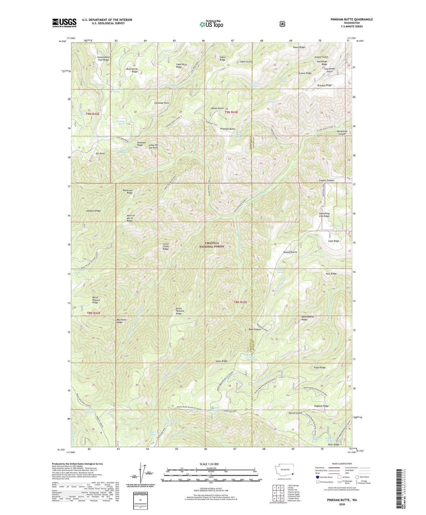
2023 topographic map quadrangle Pinkham Butte in the state of Washington. Scale: 1:24000. Based on the newly updated USGS 7.5' US Topo map series, this map is in the following counties: Garfield, Asotin. The map contains contour data, water features, and other items you are used to seeing on USGS maps, but also has updated roads and other features. This is the next generation of topographic maps. Printed on high-quality waterproof paper with UV fade-resistant inks.
Quads adjacent to this one:
West: Stentz Spring
Northwest: Rose Springs
North: Peola
Northeast: Potter Hill
East: Harlow Ridge
Southeast: Mountain View
South: Saddle Butte
Southwest: Diamond Peak
This map covers the same area as the classic USGS quad with code o46117b4.
Contains the following named places: Al Spring, Big Fir Spring, Bracken Ridge, Bracken Springs, Buckhorn Spring, Cabin Ridge, Cape Horn Ridge, Cold Spring, Cook Ridge, Cook Spring, Count Chute Ridge, Devils Tailbone Ridge, Elk Point, Fourth of July Spring, Frying Pan Spring, Getaway Point, Getaway Spring, Government Trail Ridge, Grouse Gulch, Grouse Ridge, Hogback Ridge, Horak Ranch, Horse Pasture Ridge, Horsethief Canyon, Huckleberry Ridge, Jeffreys Spring, Jones Ridge, Jump Off Joe Point, Little Mud Spring, Middle Branch North Fork Asotin Creek, Middle Point Ridge, Mud Spring Ridge, North Fork Asotin Creek Trail, Park Ridge, Patterson Ridge, Pinkham Butte, Pinkham Spring, Red Fir Spring, Round Prairie, Round Prairie Spring, Sheep Ridge, Short Ridge, Smoothing Iron Ridge, Snow Spring, Sourdough Ridge, South Fork North Fork Asotin Creek, Three C Spring, Triple Ridge, Warner Spring, Wenatchee Spring, Wickiup, Wickiup Campground, Wickiup Spring, Willow Springs