MyTopo
Violet Prairie Washington US Topo Map
Couldn't load pickup availability
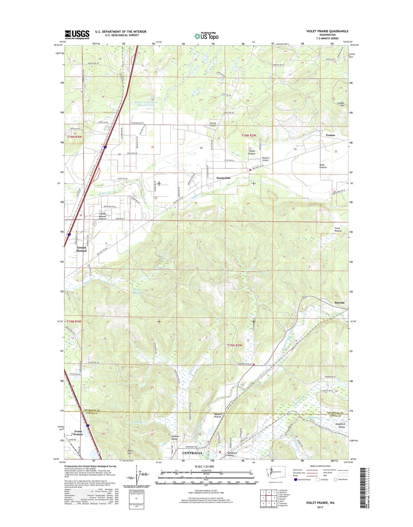
2023 topographic map quadrangle Violet Prairie in the state of Washington. Scale: 1:24000. Based on the newly updated USGS 7.5' US Topo map series, this map is in the following counties: Thurston, Lewis. The map contains contour data, water features, and other items you are used to seeing on USGS maps, but also has updated roads and other features. This is the next generation of topographic maps. Printed on high-quality waterproof paper with UV fade-resistant inks.
Quads adjacent to this one:
West: Rochester
Northwest: Littlerock
North: Maytown
Northeast: East Olympia
East: Bucoda
Southeast: Logan Hill
South: Centralia
Southwest: Adna
This map covers the same area as the classic USGS quad with code o46122g8.
Contains the following named places: Cupacoffee Creek, Davis Hill, Dunlap Pond, Dunlap Pond Dam, Foran, Grand Mound Prairie, Hanaford Valley, Kiwanis Vocational School, Kyte Dam, Lemon Hill, Lewis County Fire District 12 Riverside Fire Authority Station 3, Majestic Mine, Monarch Mine, Monte Vista Poultry Detention Pond, Monte Vista Poultry Detention Pond Dam, North Hanaford Creek, Rock Prairie, Sorrell Airport, South Hanaford Creek, Stoker Mine, Sunnydale, Thurston County Fire District 12 Tenino Fire Department Station 12 - 2, Thurston County Fire District 16 Gibson Valley Fire Department, Violet Prairie, Wissler's Airport, Zenkner Valley