MyTopo
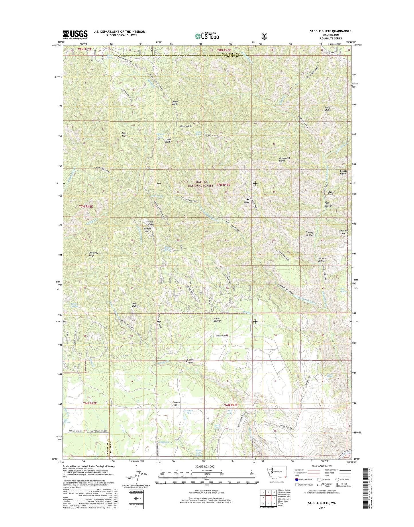
Saddle Butte Washington US Topo Map
Couldn't load pickup availability
Also explore the Saddle Butte Forest Service Topo of this same quad for updated USFS data
2023 topographic map quadrangle Saddle Butte in the state of Washington. Scale: 1:24000. Based on the newly updated USGS 7.5' US Topo map series, this map is in the following counties: Asotin, Garfield. The map contains contour data, water features, and other items you are used to seeing on USGS maps, but also has updated roads and other features. This is the next generation of topographic maps. Printed on high-quality waterproof paper with UV fade-resistant inks.
Quads adjacent to this one:
West: Diamond Peak
Northwest: Stentz Spring
North: Pinkham Butte
Northeast: Harlow Ridge
East: Mountain View
Southeast: Flora
South: Troy
Southwest: Eden Ridge
This map covers the same area as the classic USGS quad with code o46117a4.
Contains the following named places: Bell Canyon, Big Spring, Brushy Creek, Bucher Spring, Bucket Spring, Cabin Saddle, Cecil Slaybaugh, Charley Hollow, Coyote Gulch, DeSpain Spring, Driveway Ridge, East Fork Grouse Creek, Go Devil Canyon, Green School, Grouse, Grouse Flat, Grouse Flat State Wildlife Recreation Area, Grouse Spring, H A McEachan Ranch, Hewitt Spring, Hunt Spring, Indian Springs, Indian Tom Creek, James Canyon, Lake Ridge, Little Saddle, Long Ridge, Low Saddle Trail, Middle Ridge, Misery Spring, Misery Spring Campground, Monument Ridge, Mount Horrible, Ranger Creek, Ray Ridge, Road Ridge, Saddle Butte, Saddle Spring, Saddle Springs Guard Station, Service Hollow, Sheep Creek Spring, Sunbeam Ranch, Tamarack Butte, Tule Lake, Wenatchee Creek Trail, Wenatchee Guard Station, West Fork Grouse Creek, West Fork Menatchee Creek, West Wenatchee Trail