MyTopo
Skykomish Washington US Topo Map
Couldn't load pickup availability
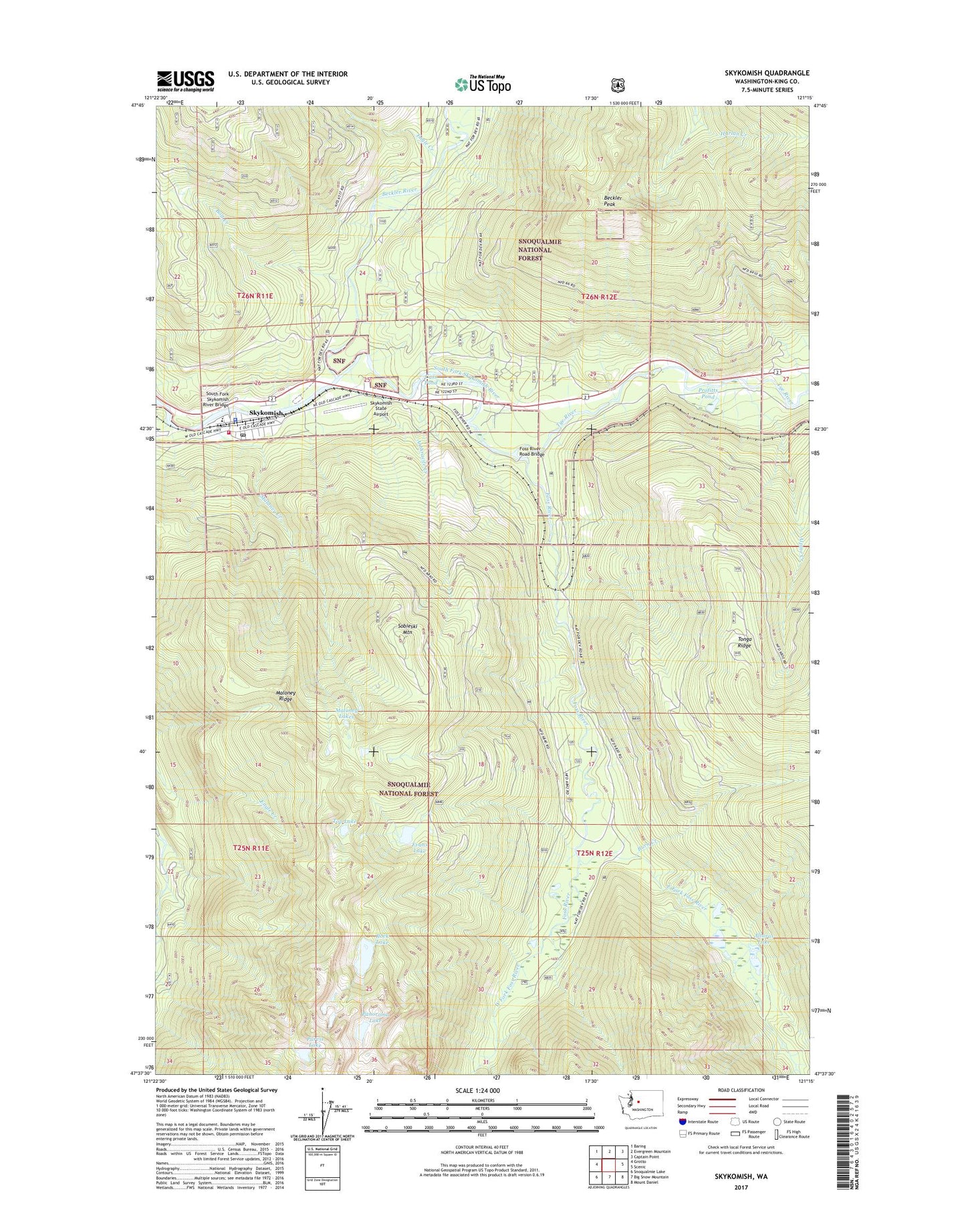
2020 topographic map quadrangle Skykomish in the state of Washington. Scale: 1:24000. Based on the newly updated USGS 7.5' US Topo map series, this map is in the following counties: King. The map contains contour data, water features, and other items you are used to seeing on USGS maps, but also has updated roads and other features. This is the next generation of topographic maps. Printed on high-quality waterproof paper with UV fade-resistant inks.
Quads adjacent to this one:
West: Grotto
Northwest: Baring
North: Evergreen Mountain
Northeast: Captain Point
East: Scenic
Southeast: Mount Daniel
South: Big Snow Mountain
Southwest: Snoqualmie Lake
Contains the following named places: Alpine Creek, Alturas Lake, Anthracite Creek, Beckler Peak, Beckler River, Beckler River Campground, Bolt Creek, Burn Creek, Cass Pond, Eagle Creek, East Fork Foss River, Evans Lake, Foss River, Foss River Camp, Foss River Campground, Foss River Road Bridge, Malaney Creek, Maloney Lakes, Maloney Ridge, Panorama Lake, Profitts Pond, Purvis Lake, Rock Lake, Skykomish, Skykomish District Ranger Office, Skykomish Fire Department King County Fire Protection District Number 50 Station Number 195, Skykomish High School, Skykomish Police Department, Skykomish Post Office, Skykomish School, Skykomish State Airport, Sobieski Mountain, South Fork Skykomish River Bridge, Top Lake, Town of Skykomish, Tye River, West Fork Foss River, ZIP Code: 98288