MyTopo
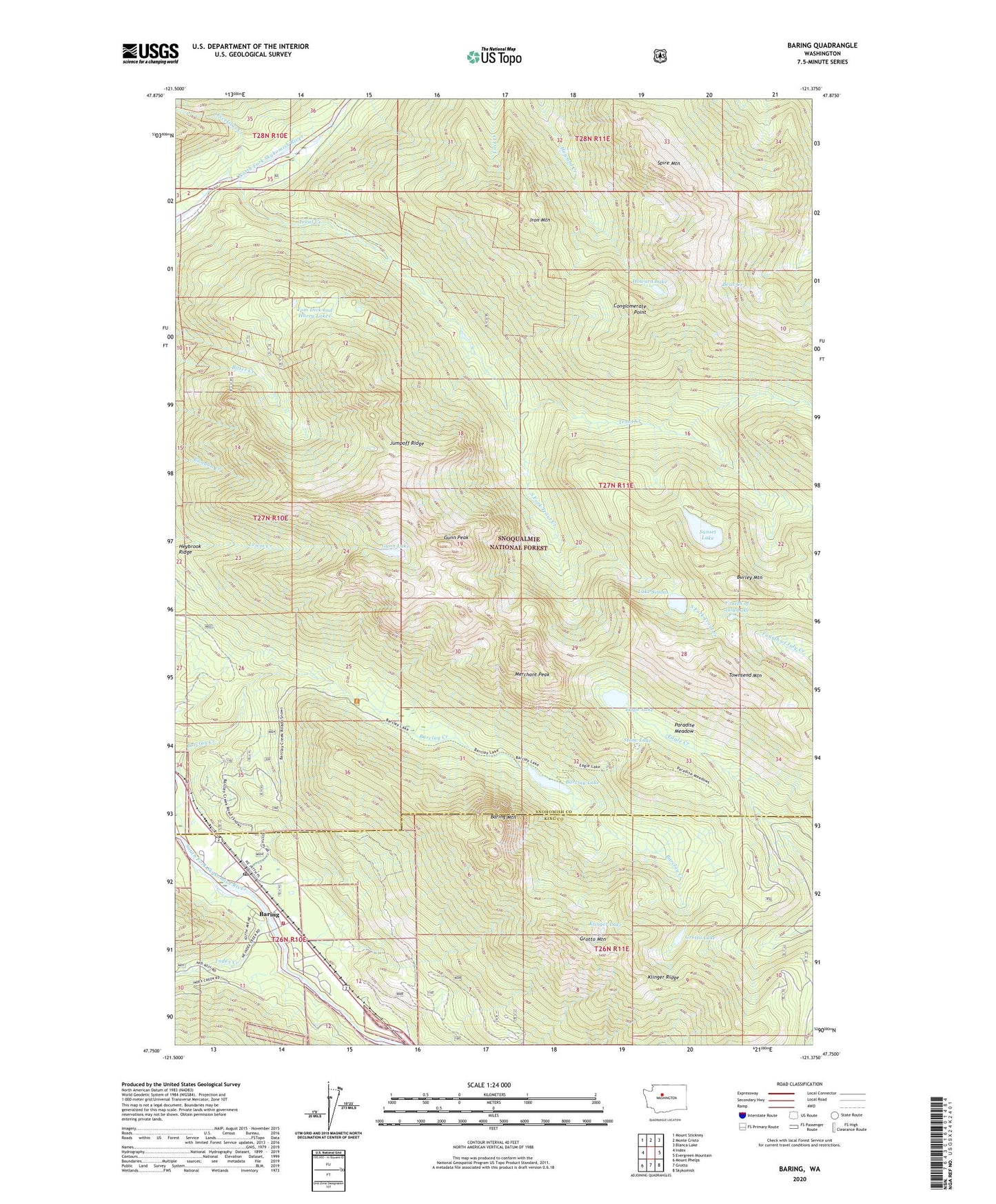
Baring Washington US Topo Map
Couldn't load pickup availability
Also explore the Baring Forest Service Topo of this same quad for updated USFS data
2023 topographic map quadrangle Baring in the state of Washington. Scale: 1:24000. Based on the newly updated USGS 7.5' US Topo map series, this map is in the following counties: Snohomish, King. The map contains contour data, water features, and other items you are used to seeing on USGS maps, but also has updated roads and other features. This is the next generation of topographic maps. Printed on high-quality waterproof paper with UV fade-resistant inks.
Quads adjacent to this one:
West: Index
Northwest: Mount Stickney
North: Monte Cristo
Northeast: Blanca Lake
East: Evergreen Mountain
Southeast: Skykomish
South: Grotto
Southwest: Mount Phelps
This map covers the same area as the classic USGS quad with code o47121g4.
Contains the following named places: Barclay Lake, Baring, Baring Census Designated Place, Baring Fire Station King County Fire Protection District 50 Station 196, Baring Mountain, Baring Post Office, Burley Mountain, Conglomerate Point, Eagle Lake, Excelsior Creek, Fourth of July Lake, Grotto Lake, Grotto Mountain, Gunn Lake, Gunn Peak, Heybrook Ridge, Howard Lake, Index Creek, Iron Mountain, Jumpoff Ridge, Klinger Lake, Klinger Ridge, Lake Simms, Merchant Peak, Paradise Meadow, South Fork Trout Creek, Spire Mountain, Stone Lake, Sunset Lake, Sunset Mine, Tom Dick and Harry Lakes, Townsend Mountain, Trout Creek, Wild Sky Wilderness, ZIP Code: 98256