MyTopo
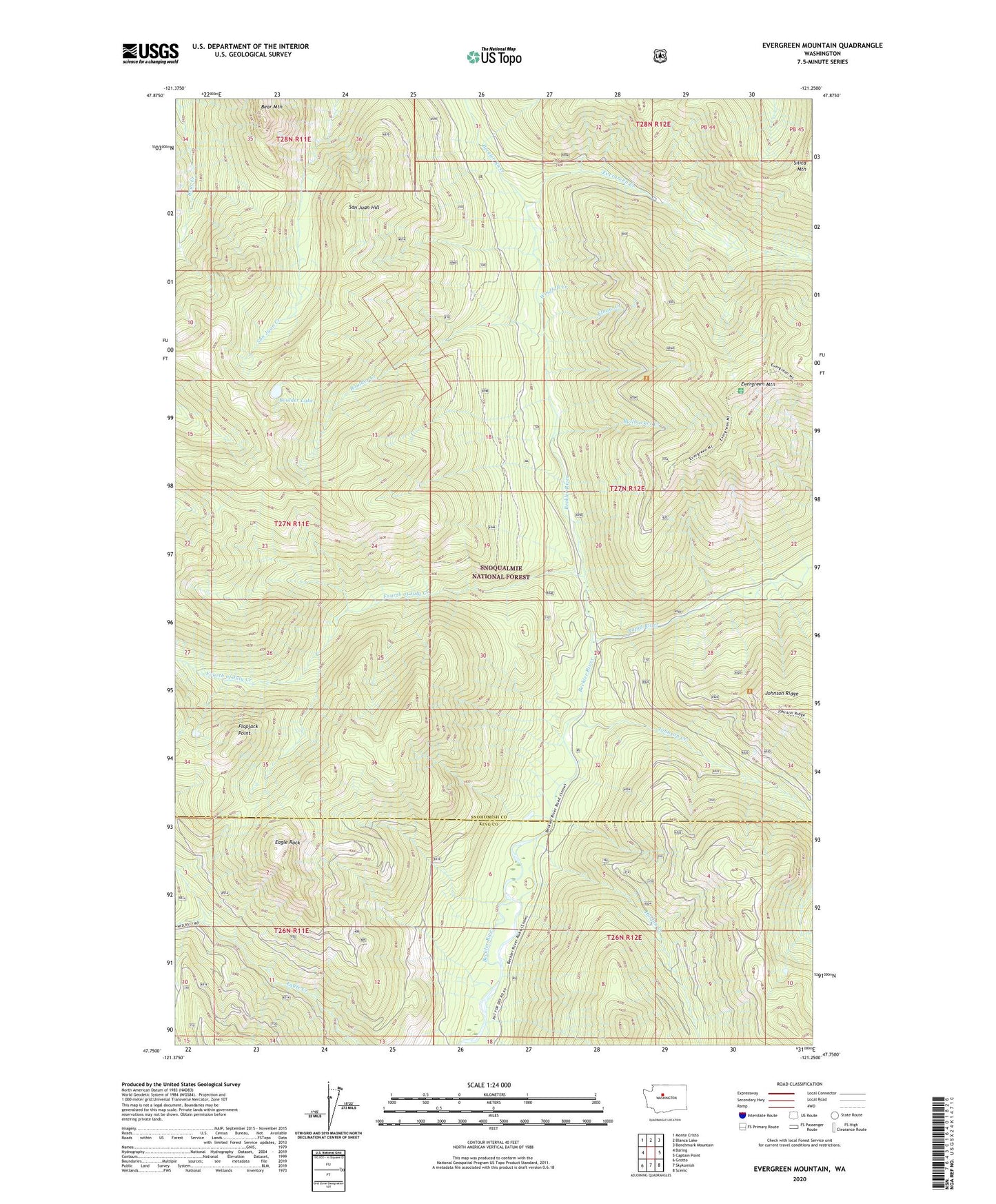
Evergreen Mountain Washington US Topo Map
Couldn't load pickup availability
Also explore the Evergreen Mountain Forest Service Topo of this same quad for updated USFS data
2023 topographic map quadrangle Evergreen Mountain in the state of Washington. Scale: 1:24000. Based on the newly updated USGS 7.5' US Topo map series, this map is in the following counties: Snohomish, King. The map contains contour data, water features, and other items you are used to seeing on USGS maps, but also has updated roads and other features. This is the next generation of topographic maps. Printed on high-quality waterproof paper with UV fade-resistant inks.
Quads adjacent to this one:
West: Baring
Northwest: Monte Cristo
North: Blanca Lake
Northeast: Benchmark Mountain
East: Captain Point
Southeast: Scenic
South: Skykomish
Southwest: Grotto
This map covers the same area as the classic USGS quad with code o47121g3.
Contains the following named places: Bear Mountain, Boulder Creek, Boulder Lake, Bullbucker Creek, Eagle Rock, El Capitan, Elbow Creek, Evergreen Creek, Evergreen Mountain, Evergreen Mountain Lookout, Flapjack Point, Fourth of July Creek, Harlan Creek, Johnson Creek, Rapid River, San Juan Hill, Silica Mountain, Skykomish Ranger District, Windfall Creek