MyTopo
Captain Point Washington US Topo Map
Couldn't load pickup availability
Also explore the Captain Point Forest Service Topo of this same quad for updated USFS data
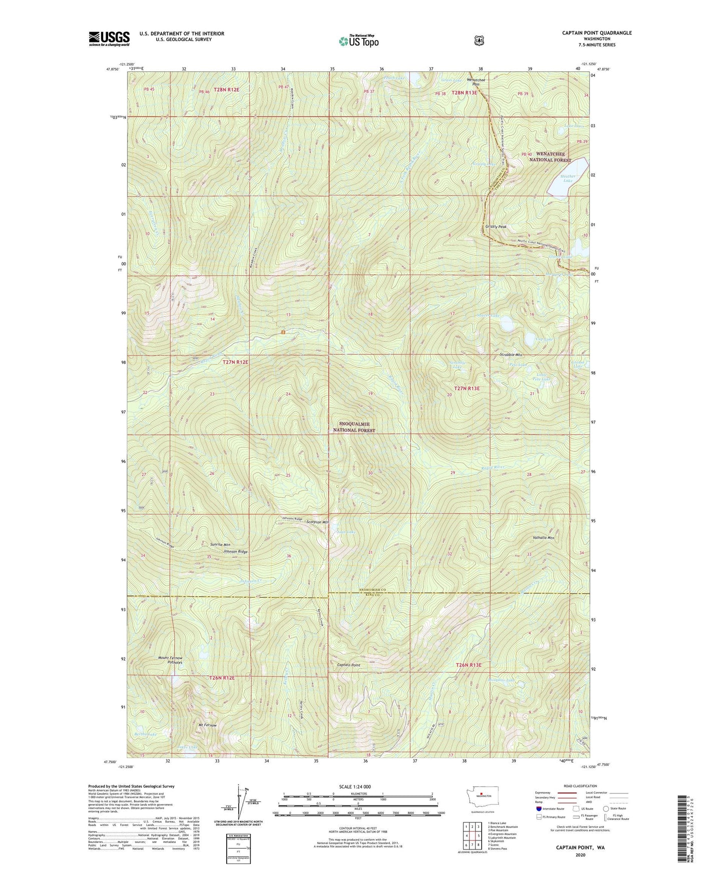
2023 topographic map quadrangle Captain Point in the state of Washington. Scale: 1:24000. Based on the newly updated USGS 7.5' US Topo map series, this map is in the following counties: Snohomish, King, Chelan. The map contains contour data, water features, and other items you are used to seeing on USGS maps, but also has updated roads and other features. This is the next generation of topographic maps. Printed on high-quality waterproof paper with UV fade-resistant inks.
Quads adjacent to this one:
West: Evergreen Mountain
Northwest: Blanca Lake
North: Benchmark Mountain
Northeast: Poe Mountain
East: Labyrinth Mountain
Southeast: Stevens Pass
South: Scenic
Southwest: Skykomish
This map covers the same area as the classic USGS quad with code o47121g2.
Contains the following named places: Bertha Lake, Captain Point, Cup Lake, Delberts Ridge, Glasses Lake, Grass Lake, Grizzly Lake, Grizzly Peak, Grouse Lake, Heather Lake, Jakes Lake, Joan Lake, Johnson Ridge, Lake Louis, Little Pete Lake, Margaret Lake, Meadow Creek, Mosquito Lake, Mount Fernow, Mount Fernow Potholes, North Fork Rapid River, Peach Lake, Pete Lake, Saucer Lake, Scorpion Mountain, Scrabble Lake, Scrabble Mountain, Sunrise Mountain, Valhalla Mountain, Wenatchee Pass