MyTopo
Swauk Prairie Washington US Topo Map
Couldn't load pickup availability
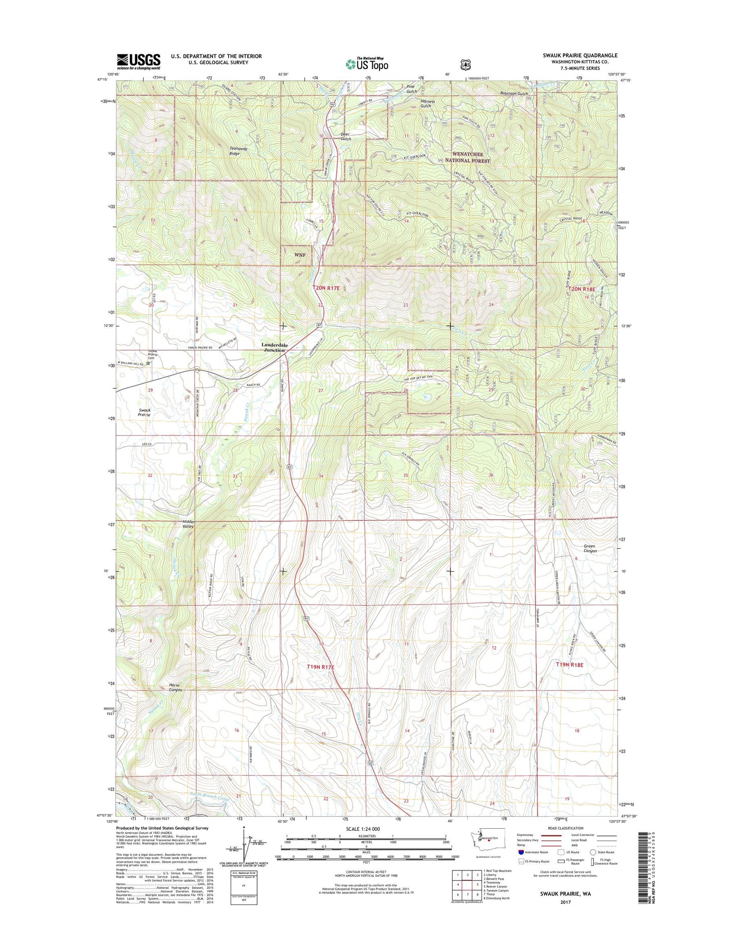
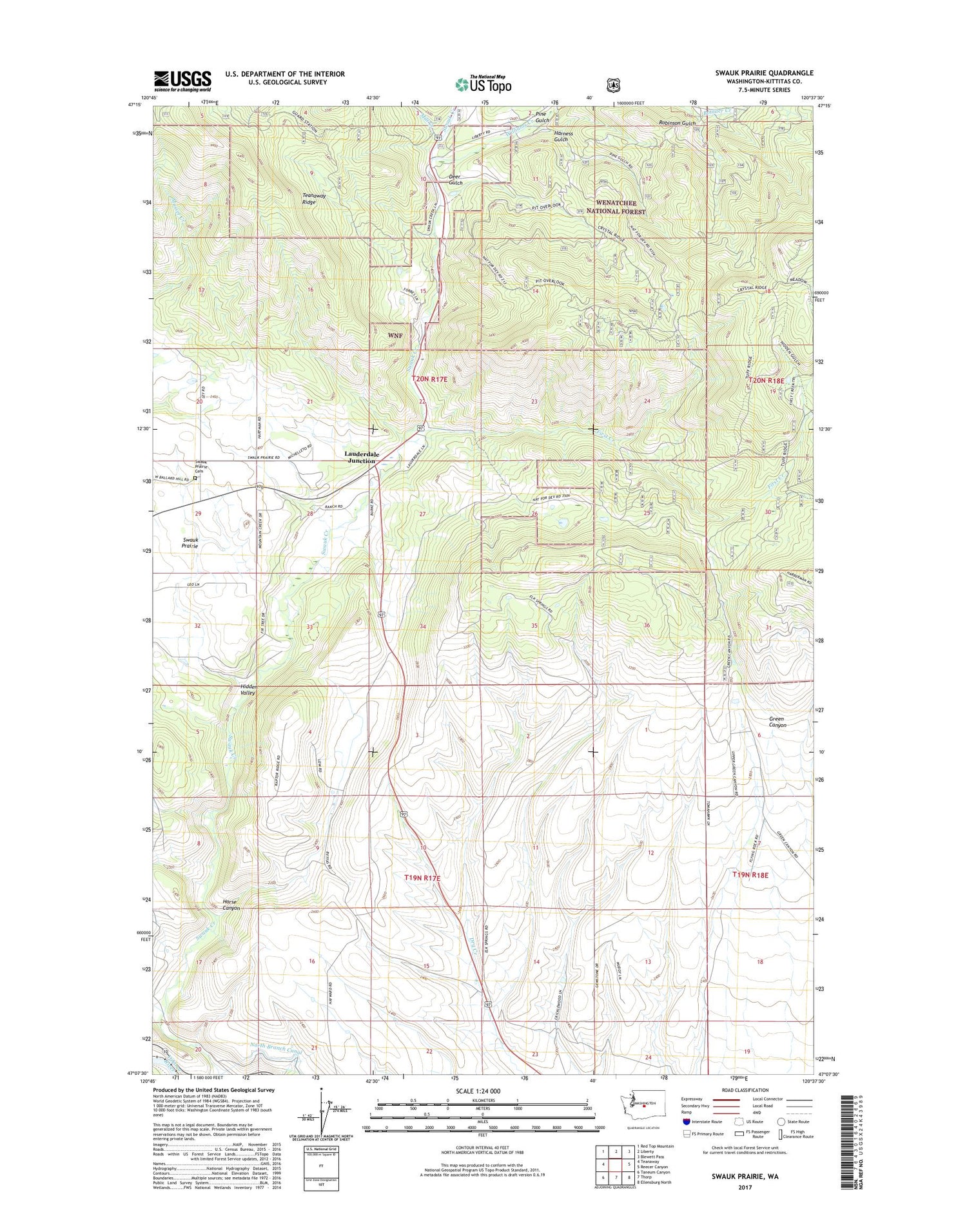
2020 topographic map quadrangle Swauk Prairie in the state of Washington. Scale: 1:24000. Based on the newly updated USGS 7.5' US Topo map series, this map is in the following counties: Kittitas. The map contains contour data, water features, and other items you are used to seeing on USGS maps, but also has updated roads and other features. This is the next generation of topographic maps. Printed on high-quality waterproof paper with UV fade-resistant inks.
Quads adjacent to this one:
West: Teanaway
Northwest: Red Top Mountain
North: Liberty
Northeast: Blewett Pass
East: Reecer Canyon
Southeast: Ellensburg North
South: Thorp
Southwest: Taneum Canyon
Contains the following named places: Deer Gulch, First Creek, Flying Rock Airpark, Green Canyon, Green Canyon Ranch, Harness Gulch, Hidden Valley, Horse Canyon, Lauderdale Junction, Liberty Guard Station, Mill Creek, Mill Pond, Old Placer Mine, Pine Gulch, Robinson Gulch, Swauk Prairie, Swauk Prairie Cemetery, Williams Creek