MyTopo
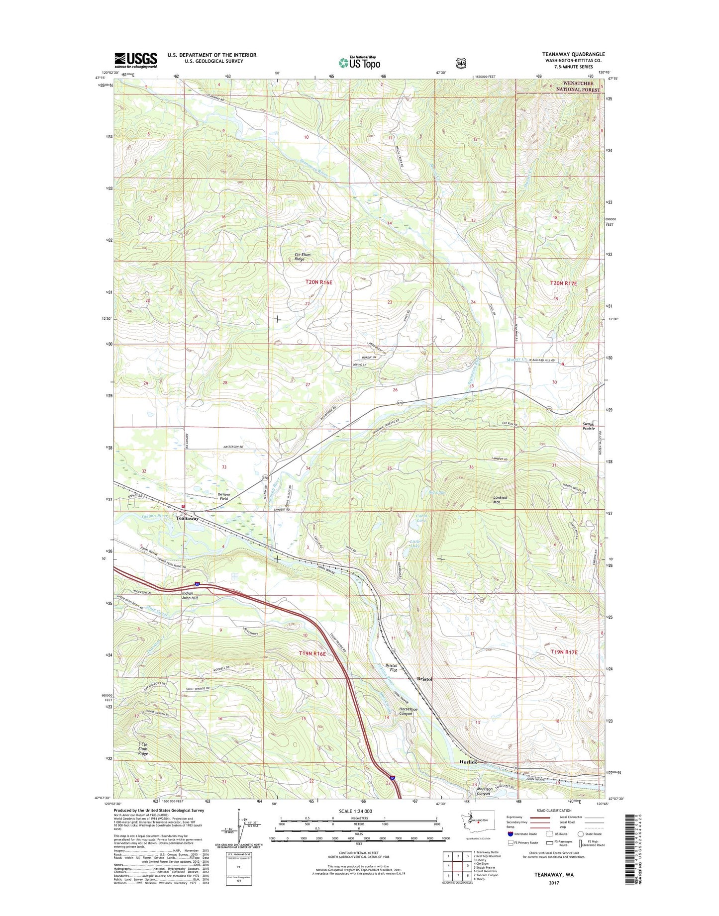
Teanaway Washington US Topo Map
Couldn't load pickup availability
2020 topographic map quadrangle Teanaway in the state of Washington. Scale: 1:24000. Based on the newly updated USGS 7.5' US Topo map series, this map is in the following counties: Kittitas. The map contains contour data, water features, and other items you are used to seeing on USGS maps, but also has updated roads and other features. This is the next generation of topographic maps. Printed on high-quality waterproof paper with UV fade-resistant inks.
Quads adjacent to this one:
West: Cle Elum
Northwest: Teanaway Butte
North: Red Top Mountain
Northeast: Liberty
East: Swauk Prairie
Southeast: Thorp
South: Taneum Canyon
Southwest: Frost Mountain
Contains the following named places: Big Lake, Bristol, Bristol Flat, Cabin Lake, Casway, De Vere Field, Horlick, Horseshoe Canyon, Indian John Hill, Kittitas County Fire District 7 Station 2, Kittitas County Fire District 7 Station 74, Kountze, Little Lake, Lookout Mountain, Mack Creek, Mason Creek, Morrison Canyon, Musser Creek, Teanaway, Teanaway River, Thornton Creek