MyTopo
Uncas Washington US Topo Map
Couldn't load pickup availability
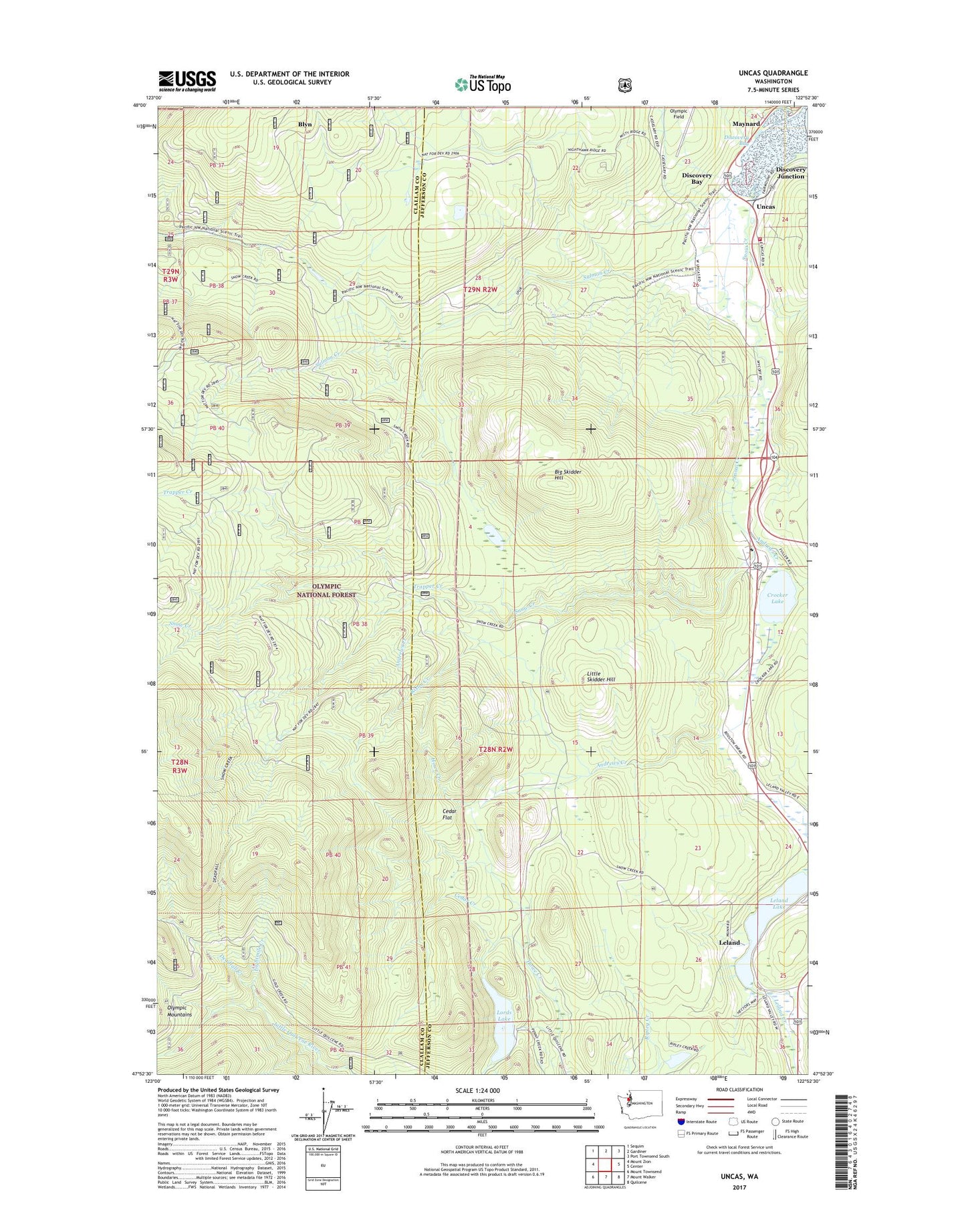
2020 topographic map quadrangle Uncas in the state of Washington. Scale: 1:24000. Based on the newly updated USGS 7.5' US Topo map series, this map is in the following counties: Jefferson, Clallam. The map contains contour data, water features, and other items you are used to seeing on USGS maps, but also has updated roads and other features. This is the next generation of topographic maps. Printed on high-quality waterproof paper with UV fade-resistant inks.
Quads adjacent to this one:
West: Mount Zion
Northwest: Sequim
North: Gardiner
Northeast: Port Townsend South
East: Center
Southeast: Quilcene
South: Mount Walker
Southwest: Mount Townsend
Contains the following named places: Andrews Creek, Big Skidder Hill, Cedar Creek, Cedar Flat, Crocker Lake, Crocker Lake Boat Launch Ramp, Deadfall Creek, Deadfall Trail, Discovery Bay, Eightmile Creek, Jefferson County Fire Protection District 5 Discovery Bay Fire Department Station 51, Leland, Leland Lake, Little Skidder Hill, Lords Lake, Lords Lake East Dam, Lords Lake North Dam, Maynard, Mount Zion Trail, Olympic Field, Rixon Creek, Salmon Creek, Snow Creek, Trapper Creek, Uncas, Uncas School