MyTopo
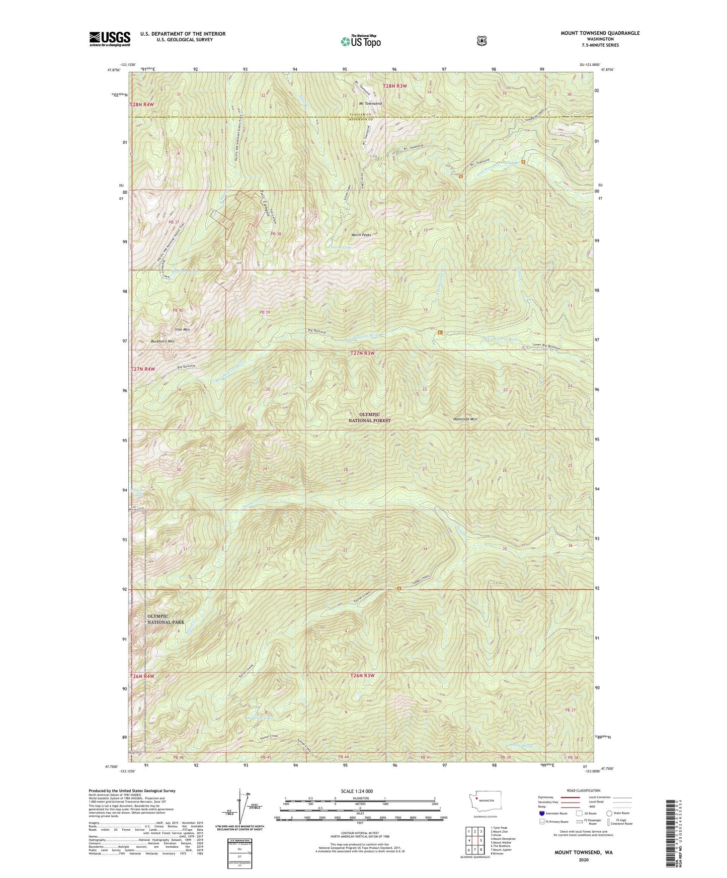
Mount Townsend Washington US Topo Map
Couldn't load pickup availability
Also explore the Mount Townsend Forest Service Topo of this same quad for updated USFS data
2023 topographic map quadrangle Mount Townsend in the state of Washington. Scale: 1:24000. Based on the newly updated USGS 7.5' US Topo map series, this map is in the following counties: Jefferson, Clallam. The map contains contour data, water features, and other items you are used to seeing on USGS maps, but also has updated roads and other features. This is the next generation of topographic maps. Printed on high-quality waterproof paper with UV fade-resistant inks.
Quads adjacent to this one:
West: Mount Deception
Northwest: Tyler Peak
North: Mount Zion
Northeast: Uncas
East: Mount Walker
Southeast: Brinnon
South: Mount Jupiter
Southwest: The Brothers
This map covers the same area as the classic USGS quad with code o47123g1.
Contains the following named places: Big Canyon Camp, Buckhorn Lake, Buckhorn Mountain, Camp Jolley, Camp Mystery, Camp Windy, Copper City, Hamilton Mountain, Harrison Lake, Iron Mountain, Jolley Creek, Mount Townsend, Mount Townsend Lookout, Quilcene Bay-Brinnon Division, Quilcene Ranger District, Shelter Rock Camp, Silver Lake, Sink Lake, Tenmile Shelter, Tubal Cain Mine, Tull Canyon, Tunnel Creek Shelter, Welch Peaks, Wet Weather Creek