MyTopo
Western Washington US Topo Map
Couldn't load pickup availability
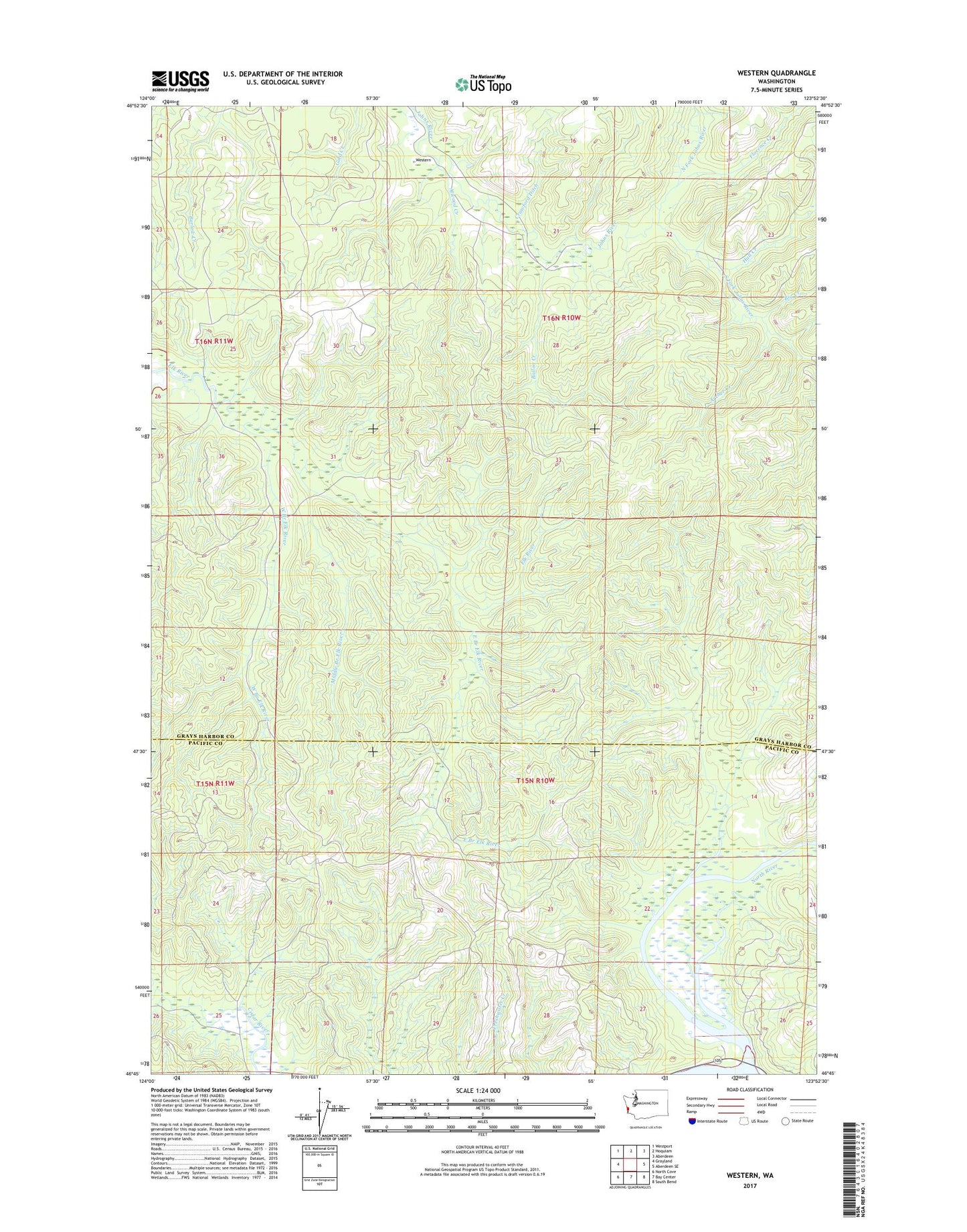
2020 topographic map quadrangle Western in the state of Washington. Scale: 1:24000. Based on the newly updated USGS 7.5' US Topo map series, this map is in the following counties: Grays Harbor, Pacific. The map contains contour data, water features, and other items you are used to seeing on USGS maps, but also has updated roads and other features. This is the next generation of topographic maps. Printed on high-quality waterproof paper with UV fade-resistant inks.
Quads adjacent to this one:
West: Grayland
Northwest: Westport
North: Hoquiam
Northeast: Aberdeen
East: Aberdeen SE
Southeast: South Bend
South: Bay Center
Southwest: North Cove
Contains the following named places: Archer Creek, Atwood Creek, Ballon Creek, Big Creek, Crawford Ditch, East Branch Elk River, Florence Creek, Hall Creek, Middle Branch Elk River, North Fork Johns River, South Fork Johns River, West Branch Elk River, Western