MyTopo
White Chuck Mountain Washington US Topo Map
Couldn't load pickup availability
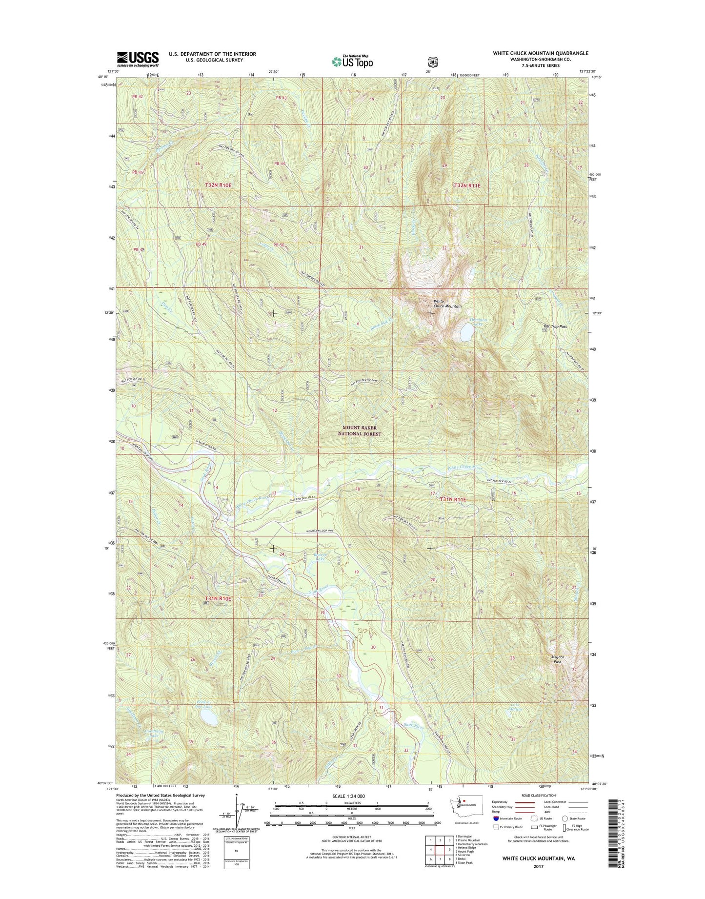
2020 topographic map quadrangle White Chuck Mountain in the state of Washington. Scale: 1:24000. Based on the newly updated USGS 7.5' US Topo map series, this map is in the following counties: Snohomish. The map contains contour data, water features, and other items you are used to seeing on USGS maps, but also has updated roads and other features. This is the next generation of topographic maps. Printed on high-quality waterproof paper with UV fade-resistant inks.
Quads adjacent to this one:
West: Helena Ridge
Northwest: Darrington
North: Prairie Mountain
Northeast: Huckleberry Mountain
East: Mount Pugh
Southeast: Sloan Peak
South: Bedal
Southwest: Silverton
Contains the following named places: Beaver Lake, Black Oak Creek, Brown Creek, Conn Creek, Darrington Division, Dubor Creek, Dutch Creek, Falls Creek, Goodman Creek, Goodman Lake, Lake Metam, Mount Baker National Forest, Peek-a-boo Creek, Peek-a-boo Lake, Rat Trap Pass, Stujack Creek, Stujack Pass, Thornton Lake, White Chuck Campground, White Chuck Lakes, White Chuck Mountain, White Chuck River, Whitewater Launch