MyTopo
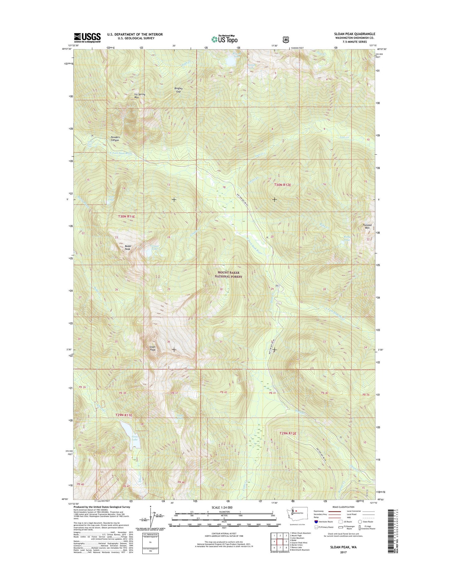
Sloan Peak Washington US Topo Map
Couldn't load pickup availability
Also explore the Sloan Peak Forest Service Topo of this same quad for updated USFS data
2023 topographic map quadrangle Sloan Peak in the state of Washington. Scale: 1:24000. Based on the newly updated USGS 7.5' US Topo map series, this map is in the following counties: Snohomish. The map contains contour data, water features, and other items you are used to seeing on USGS maps, but also has updated roads and other features. This is the next generation of topographic maps. Printed on high-quality waterproof paper with UV fade-resistant inks.
Quads adjacent to this one:
West: Bedal
Northwest: White Chuck Mountain
North: Mount Pugh
Northeast: Lime Mountain
East: Glacier Peak West
Southeast: Benchmark Mountain
South: Blanca Lake
Southwest: Monte Cristo
This map covers the same area as the classic USGS quad with code o48121a3.
Contains the following named places: Bedal Peak, Bingley Gap, Bowser Creek, Cadet Creek, Cadet Lake, Cougar Creek, Cougar Lake, Garnet Creek, Goat Lake, Ira Spring Mountain, Lost Creek, Lost Creek Ridge Trail, Nels Lake, North Fork Falls, Painted Mountain, Penders Canyon, Red Mountain Lookout, Round Lake, Ruby Creek, Ruby Lake, Sloan Creek, Sloan Creek Campground, Sloan Peak, Sunup Lake, Zi-iob Peak