MyTopo
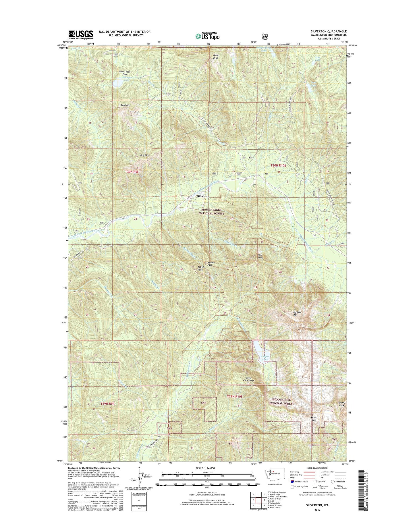
Silverton Washington US Topo Map
Couldn't load pickup availability
Also explore the Silverton Forest Service Topo of this same quad for updated USFS data
2023 topographic map quadrangle Silverton in the state of Washington. Scale: 1:24000. Based on the newly updated USGS 7.5' US Topo map series, this map is in the following counties: Snohomish. The map contains contour data, water features, and other items you are used to seeing on USGS maps, but also has updated roads and other features. This is the next generation of topographic maps. Printed on high-quality waterproof paper with UV fade-resistant inks.
Quads adjacent to this one:
West: Mallardy Ridge
Northwest: Whitehorse Mountain
North: Helena Ridge
Northeast: White Chuck Mountain
East: Bedal
Southeast: Monte Cristo
South: Mount Stickney
Southwest: Wallace Lake
This map covers the same area as the classic USGS quad with code o48121a5.
Contains the following named places: Bald Mountain, Beaver Creek, Beaver Creek Camp, Bender Creek, Big Four, Big Four Camp, Big Four Mountain, Big Four Post Office, Blackjack Lookout, Bonanza Queen Mine, Camp Silverton-Wadheim, Coal Creek, Coal Creek Camp, Coal Lake, Coal Lake Viewpoint, Copper Lake, Deer Creek, Deer Creek Campground, Deer Creek Pass, Devils Peak, Dick Sperry Campground, Everett Creek, Hall Peak, Independence Lake, Kelcema Lake, Little Chief Peak, Long Mountain, Marble Gulch, Marble Pass, Marble Peak, Marien Creek Campground, Marten Creek, Pass Lake, Perry Creek, Perry Creek Campground, Saint Louis Mine, Silver Gulch, Silverton, Silverton Post Office, Sperry Peak, Stony Creek, Vesper Peak