MyTopo
Philippi West Virginia US Topo Map
Couldn't load pickup availability
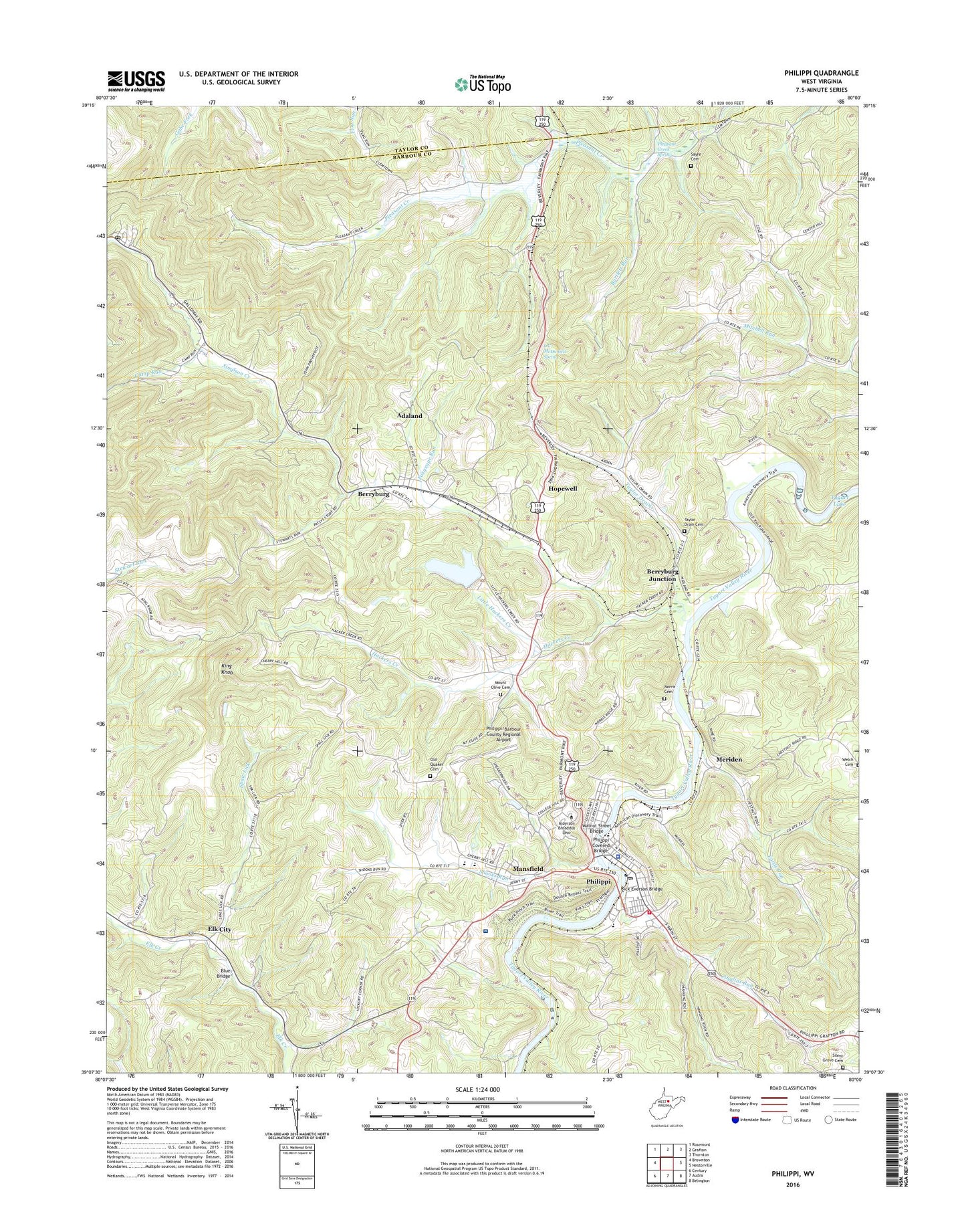
2023 topographic map quadrangle Philippi in the state of West Virginia. Scale: 1:24000. Based on the newly updated USGS 7.5' US Topo map series, this map is in the following counties: Barbour, Taylor. The map contains contour data, water features, and other items you are used to seeing on USGS maps, but also has updated roads and other features. This is the next generation of topographic maps. Printed on high-quality waterproof paper with UV fade-resistant inks.
Quads adjacent to this one:
West: Brownton
Northwest: Rosemont
North: Grafton
Northeast: Thornton
East: Nestorville
Southeast: Belington
South: Audra
Southwest: Century
This map covers the same area as the classic USGS quad with code o39080b1.
Contains the following named places: Adaland, Alderson Broaddus University, Anglins Run, Barbour County, Barbour County Courthouse, Barbour County Emergency Squad Station 16, Barbour County Farm, Barbour County Historical Museum, Barbour County Sheriff's Office, Bartlett Run, Berryburg, Berryburg Junction, Berryburg School, Blue and Gray Park, Blue Bridge, Boylen, Broaddus Hospital, Camp Run, Carlin School, Center Hill School, Chestnut Ridge Church, City of Philippi, City of Philippi Convention & Visitors Bureau, Corder Crossing, Covered Bridge Museum, Crim Memorial United Methodist Church, Dayton Park, Ebenezer Church, Elk City, Elk City Church, Feed My Sheep Christian School, Fords Run, Fords Run Church, Fords Run School, Fox Hall, Foxgrape Run, Galloway, Galloway Post Office, Hackers Creek, Hackers Creek Baptist Church, Hackers School, Hanging Rock School, Hopewell, King Knob, L C McDaniels Spring, Little Hackers Creek, Little Laurel Run, Lough School, Mansfield, Mansfield School, Marys Chapel, Memorial Park, Meriden, Meriden School, Midlan, Mount Olive Baptist Church, Mount Olive Old School Baptist Church Cemetery, Norris Cemetery, Old Quaker Cemetery, Philippi, Philippi Baptist Church, Philippi City Hall, Philippi Covered Bridge, Philippi Elementary School, Philippi Head Start Center, Philippi Historic District, Philippi Middle School, Philippi Police Department, Philippi Post Office, Philippi Presbyterian Church, Philippi United Methodist Church, Philippi Volunteer Fire Department, Philippi/Barbour County Regional Airport, Pleasant Creek, Pleasant Creek Spring, Pleasant Creek United Methodist Church, Pleasant Creek Wildlife Management Area, Point Pleasant Baptist Church, Rick Everson Bridge, Rockcamp Run, Sayre Cemetery, Shooks Run, Shooks Run School, Silent Grove Baptist Church, Silent Grove Cemetery, Silent Grove School, Spaw Lick, Spawlick School, Taylor Drain, Taylor Drain Cemetery, Taylor Drain School, Tygart Glen, Walnut Street Bridge, Wellington Heights, West District, West Virginia Division of Forestry Barbour County Field Office, WQAB-FM (Philippi), ZIP Code: 26416