MyTopo
Colebank West Virginia US Topo Map
Couldn't load pickup availability
Also explore the Colebank Forest Service Topo of this same quad for updated USFS data
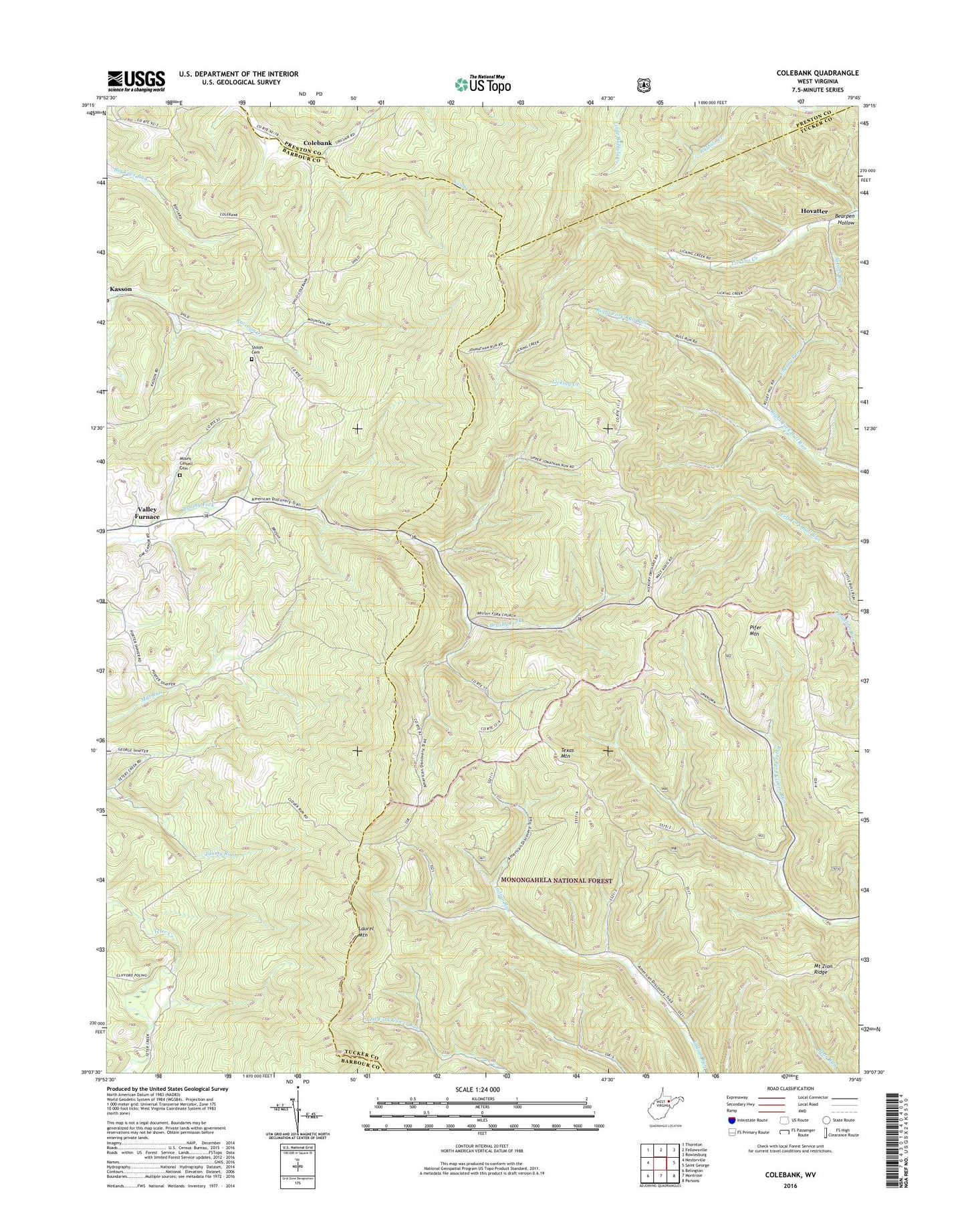
2023 topographic map quadrangle Colebank in the state of West Virginia. Scale: 1:24000. Based on the newly updated USGS 7.5' US Topo map series, this map is in the following counties: Tucker, Barbour, Preston. The map contains contour data, water features, and other items you are used to seeing on USGS maps, but also has updated roads and other features. This is the next generation of topographic maps. Printed on high-quality waterproof paper with UV fade-resistant inks.
Quads adjacent to this one:
West: Nestorville
Northwest: Thornton
North: Fellowsville
Northeast: Rowlesburg
East: Saint George
Southeast: Parsons
South: Montrose
Southwest: Belington
This map covers the same area as the classic USGS quad with code o39079b7.
Contains the following named places: Bearpen Hollow, Berea Methodist Church, Brushy Fork Church, Brushy Fork School, Bull Run School, Cherry Run, Clover District, Colebank, Cross School, Digman School, Hobson, Hovatter, Jacobs Run, Kasson United Methodist Church, Laurel Mountain, Liberty School, Licking Creek School, Locust Grove Church, Mount Cassell Cemetery, Mount Castle Church, Mount Zion Church, Mount Zion Ridge, Mount Zion School, Murphy School, New Hope Church, Pifer Mountain, Pifer Mountain Church, Pifer School, Shiloh Cemetery, Shiloh Church, Stony Run, Sugargrove Church, Texas, Texas Mountain, Union Chapel, Valley School, West Point School, Wolf School