MyTopo
Droop West Virginia US Topo Map
Couldn't load pickup availability
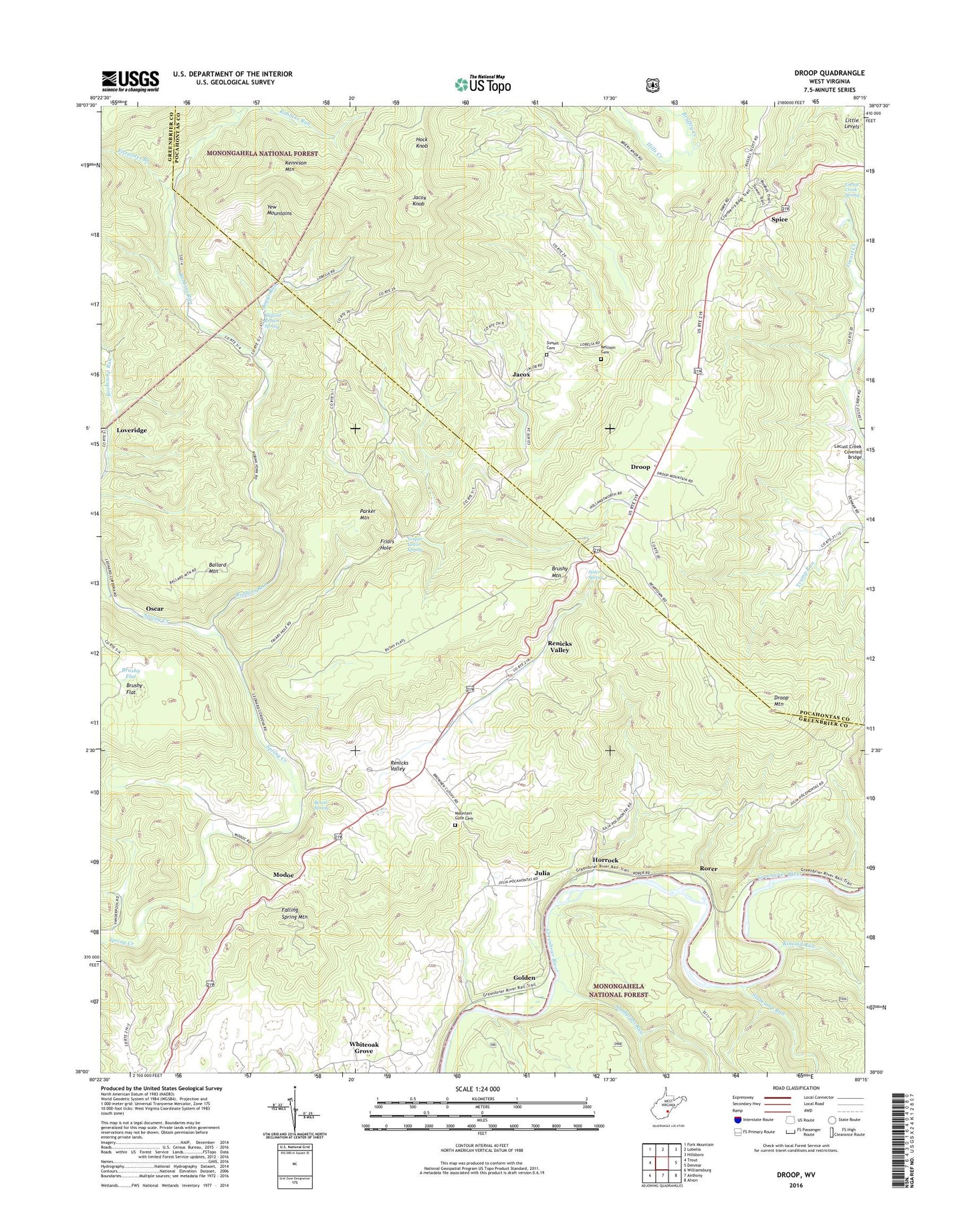
2019 topographic map quadrangle Droop in the state of West Virginia. Scale: 1:24000. Based on the newly updated USGS 7.5' US Topo map series, this map is in the following counties: Greenbrier, Pocahontas. The map contains contour data, water features, and other items you are used to seeing on USGS maps, but also has updated roads and other features. This is the next generation of topographic maps. Printed on high-quality waterproof paper with UV fade-resistant inks.
Quads adjacent to this one:
West: Trout
Northwest: Fork Mountain
North: Lobelia
Northeast: Hillsboro
East: Denmar
Southeast: Alvon
South: Anthony
Southwest: Williamsburg
Contains the following named places: Ballard Mountain, Beard Spring, Beartown State Park, Bethel Church, Beulah Church, Boggs Run, Boggs Run School, Bruffey Creek, Brushy Flat, Brushy Mountain, Clifford Brown Spring, Droop, Droop Mountain, Droop Mountain Battlefield Museum, Droop Mountain Battlefield State Park, Falling Spring Mountain, Fitzwater Branch, Friars Hole, Golden, Grace Church, Hills Chapel, Hills Creek, Hock Knob, Horrock, Jacox, Jacox Knob, Julia, Kellison Cemetery, Kennison Mountain, Kincaid Run, Laurel Hill School, Locust Creek Church, Locust Creek Covered Bridge, Locust Creek Spring, Loveridge, Mill Spring School, Modoc, Morgan Memorial Church, Mount Lebanon School, Mount Olivet United Methodist Church, Mount Zion United Methodist Church, Mountain Gate Cemetery, Oak Grove School, Oscar, Parker Mountain, Parker School, Renicks Valley, Robbins Run, Rockcamp School, Rorer, Sisler Spring, Slabcamp Run, Snodgrass Run, Snodgrass Run Trail, Spice, Sugar Grove School, Sunrise School, Sunset Cemetery, Trump Run School, Vesper Lewis Spring, West Droop School, Whiteoak Grove, ZIP Code: 24966