MyTopo
Fork Mountain West Virginia US Topo Map
Couldn't load pickup availability
Also explore the Fork Mountain Forest Service Topo of this same quad for updated USFS data
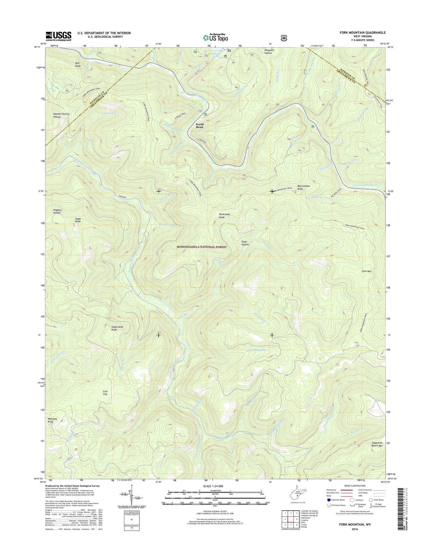
2023 topographic map quadrangle Fork Mountain in the state of West Virginia. Scale: 1:24000. Based on the newly updated USGS 7.5' US Topo map series, this map is in the following counties: Greenbrier, Nicholas, Webster. The map contains contour data, water features, and other items you are used to seeing on USGS maps, but also has updated roads and other features. This is the next generation of topographic maps. Printed on high-quality waterproof paper with UV fade-resistant inks.
Quads adjacent to this one:
West: Richwood
Northwest: Camden On Gauley
North: Webster Springs SW
Northeast: Webster Springs SE
East: Lobelia
Southeast: Droop
South: Trout
Southwest: Duo
This map covers the same area as the classic USGS quad with code o38080b4.
Contains the following named places: Armstrong Run, Bearwallow Knob, Becky Run, Beech Lick Run, Big Glady Run, Big Lick Run, Big Run, Big Run Trail, Blizzard Run, Briery Run, Bumblebee Run, Camp 29 Run, Carpenter Run, Coats Run, Cold Knob Fork, Coon Run, Deacon Run, Elklick Run, Epling Run, Fallen Timber Run, Fork Mountain, Fork Mountain Trail, Hacking Run, Hamrick Run, Hunters Run, Little Blizzard Run, Little Glady Run, Little Lick Run, Little Rocky Run, Lost Flat, Manning Knob, Mill Knob, Mitchell Run, North Bend, North Bend Picnic Area, Pocahontas Trail, Rabbit Run, Rockcamp Knob, Rocky Run, Rough Fork, Shiras Run, Slide Hollow, Sugar Knob, Sugarcamp Knob, Summit Lake Campground, Summit Lake Dam, Tenmile Branch, Windy Run