MyTopo
Duo West Virginia US Topo Map
Couldn't load pickup availability
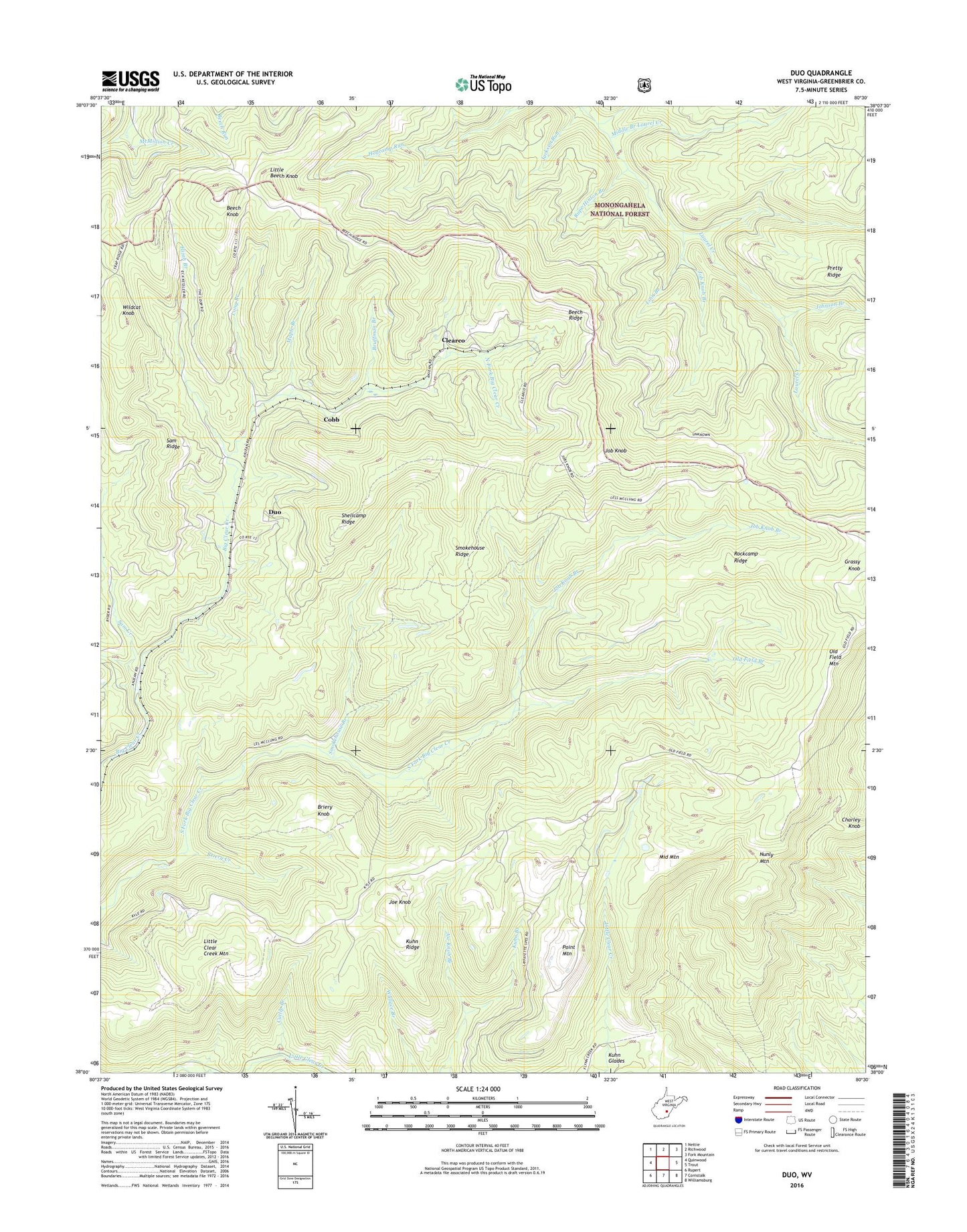
2019 topographic map quadrangle Duo in the state of West Virginia. Scale: 1:24000. Based on the newly updated USGS 7.5' US Topo map series, this map is in the following counties: Greenbrier. The map contains contour data, water features, and other items you are used to seeing on USGS maps, but also has updated roads and other features. This is the next generation of topographic maps. Printed on high-quality waterproof paper with UV fade-resistant inks.
Quads adjacent to this one:
West: Quinwood
Northwest: Nettie
North: Richwood
Northeast: Fork Mountain
East: Trout
Southeast: Williamsburg
South: Cornstalk
Southwest: Rupert
Contains the following named places: Beech Knob, Beech Ridge, Briery Creek, Briery Knob, Bruffman Branch, Clearco, Cobb, Cold Spring Branch, Cutlip Branch, Duo, Elijah Branch, Jackson Run, Job Knob, Job Knob Branch, Joe Knob, Joe Knob Branch, Johnson Branch, Kuhn Glades, Kuhn Ridge, Linn Branch, Little Beech Knob, Little Clear Creek Mountain, Long Branch, Manning Branch, Maple Branch, Middle Branch Laurel Creek, Middle Mountain, North Fork Big Clear Creek, Nunly Mountain, Old Field Branch, Old Field Mountain, Point Mountain, Rockcamp Ridge, Rupe Hinton Branch, Sam Creek, Sam Ridge, Shellcamp Ridge, Smokehouse Branch, Smokehouse Ridge, Wildcat Knob, ZIP Code: 25984