MyTopo
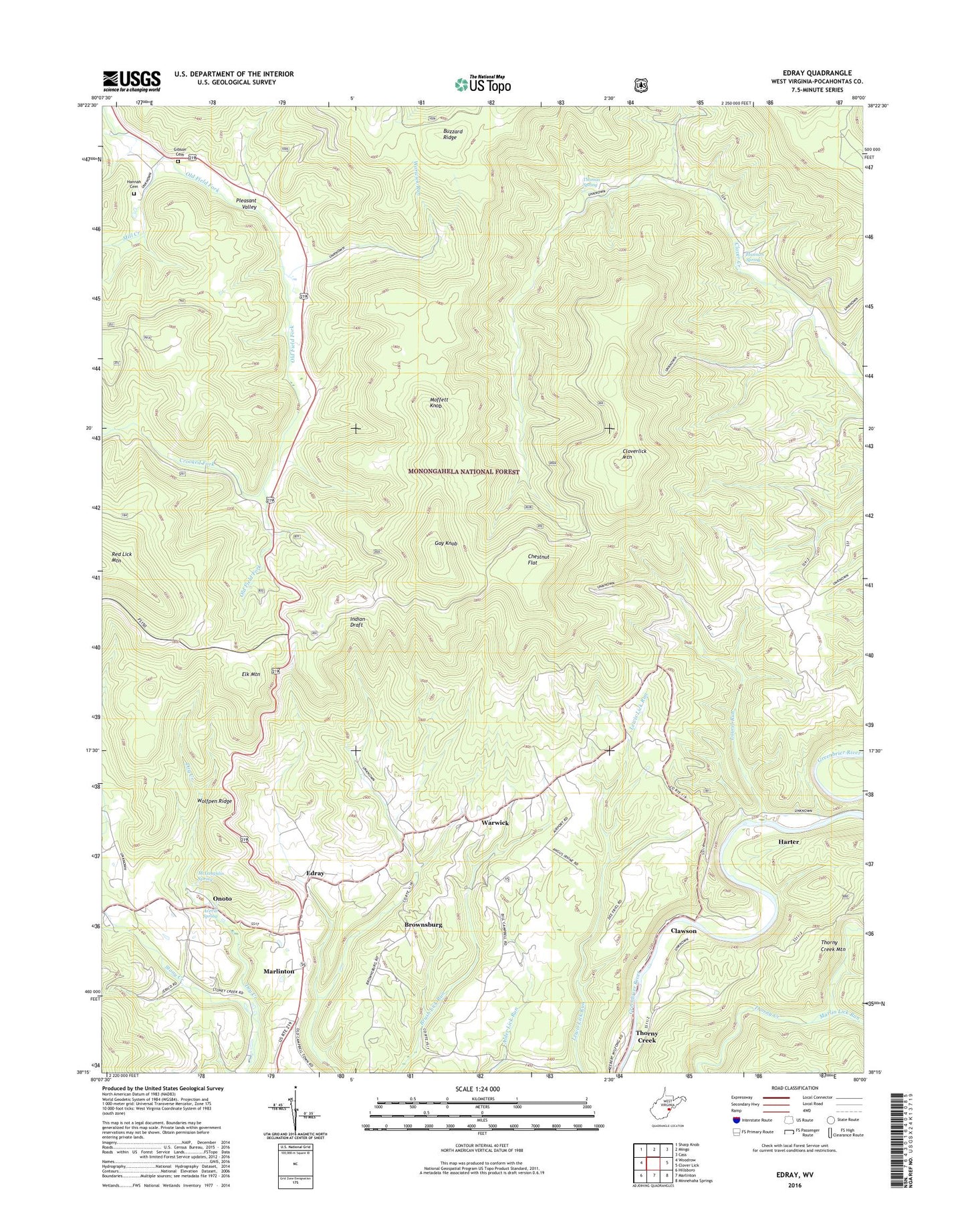
Edray West Virginia US Topo Map
Couldn't load pickup availability
Also explore the Edray Forest Service Topo of this same quad for updated USFS data
2023 topographic map quadrangle Edray in the state of West Virginia. Scale: 1:24000. Based on the newly updated USGS 7.5' US Topo map series, this map is in the following counties: Pocahontas. The map contains contour data, water features, and other items you are used to seeing on USGS maps, but also has updated roads and other features. This is the next generation of topographic maps. Printed on high-quality waterproof paper with UV fade-resistant inks.
Quads adjacent to this one:
West: Woodrow
Northwest: Sharp Knob
North: Mingo
Northeast: Cass
East: Clover Lick
Southeast: Minnehaha Springs
South: Marlinton
Southwest: Hillsboro
This map covers the same area as the classic USGS quad with code o38080c1.
Contains the following named places: Averill Spring, Brownsburg, Brownsburg School, Brushy Flat School, Central Union Church, Chestnut Flat, Clawson, Clawson School, Cloverlick Mountain, Crooked Fork, Crooked Fork School, Dry Creek, Edray, Edray District, Edray District High School, Edray School House, Edray Trout Hatchery, Edray United Methodist Church, Elk Mountain, Fairview Church, Fairview School, Gay Knob, Gay Knob Fire Tower, Gibson Cemetery, Hamlin United Methodist Church, Hannah Cemetery, Hannan Spring, Harter, Laurel Run, Marlin Lick Run, Marys Chapel, McLaughlin Spring, Mill Creek, Moffett Knob, Mount Pleasant Church, Mount Pleasant School, New Pleasant Valley School, Onoto, Pine Grove School, Pleasant Ridge School, Pleasant Valley, Poage Lane School, Pocahontas County, Stony Creek Presbyterian Church, Thomas Spring, Thomas Spring School, Thorny Creek, Warwick, Warwick Run, West Virginia State Fish Hatchery, Wilson Chapel, Wolfpen Ridge, Woods-Poage Chapel