MyTopo
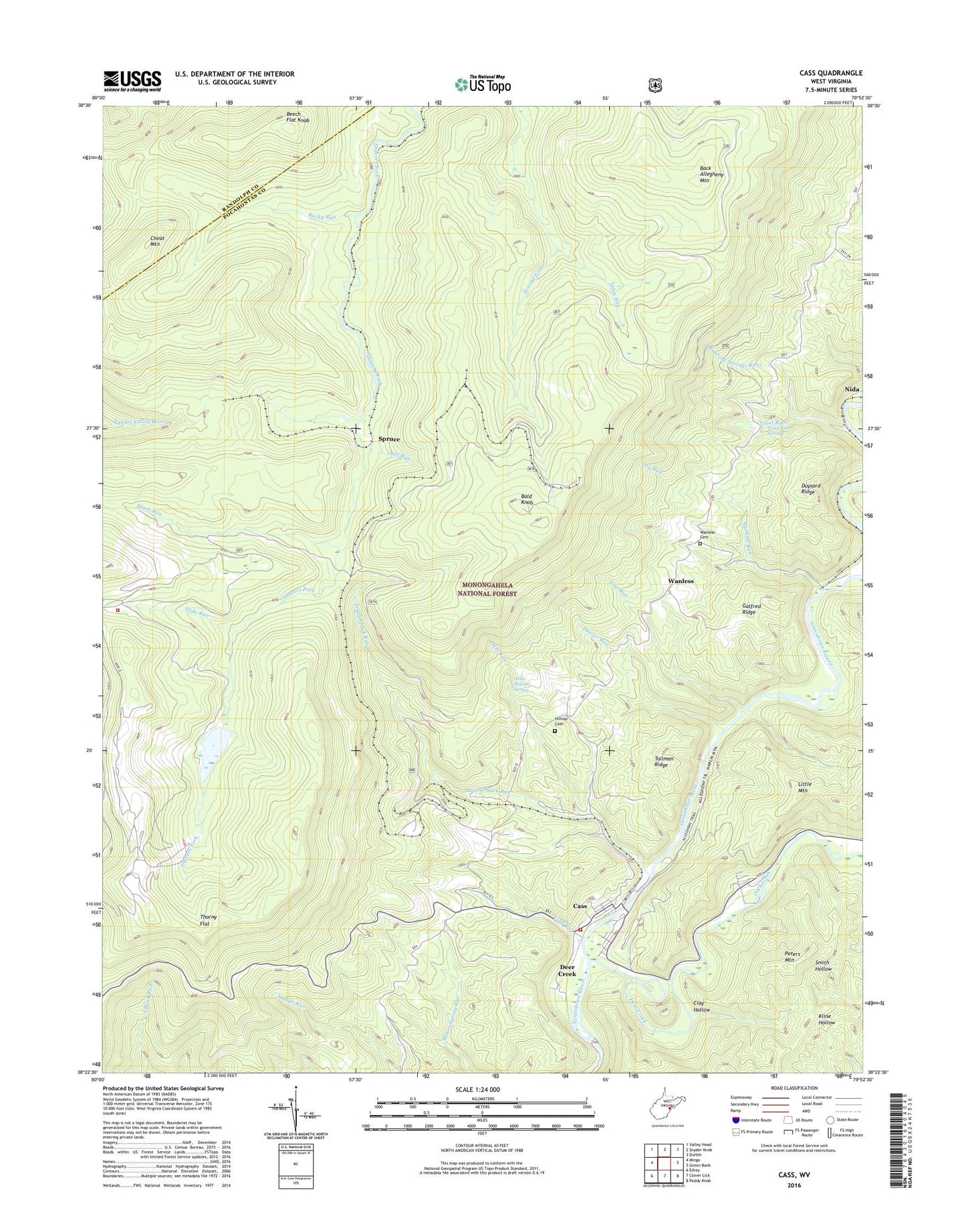
Cass West Virginia US Topo Map
Couldn't load pickup availability
Also explore the Cass Forest Service Topo of this same quad for updated USFS data
2023 topographic map quadrangle Cass in the state of West Virginia. Scale: 1:24000. Based on the newly updated USGS 7.5' US Topo map series, this map is in the following counties: Pocahontas, Randolph. The map contains contour data, water features, and other items you are used to seeing on USGS maps, but also has updated roads and other features. This is the next generation of topographic maps. Printed on high-quality waterproof paper with UV fade-resistant inks.
Quads adjacent to this one:
West: Mingo
Northwest: Valley Head
North: Snyder Knob
Northeast: Durbin
East: Green Bank
Southeast: Paddy Knob
South: Clover Lick
Southwest: Edray
This map covers the same area as the classic USGS quad with code o38079d8.
Contains the following named places: Arlie Righter Spring, Back Allegheny Mountain, Bald Knob, Bald Knob Lookout Tower, Beech Flat Knob, Black Run, Cass, Cass Census Designated Place, Cass Historical District, Cass Historical Museum, Cass Scenic Railroad State Park, Cass School, Cass Volunteer Fire and Rescue, Clay Hollow, Cold Run, Cold Run School, Cup Run, Deer Creek, Deever Run, Dry Run, Duysard Ridge, Galfred Ridge, Hilltop Cemetery, Leatherbark Run, McLaughlin Church, Mill Run, Nida, Oats Run, Odey Run, Oliver School, Peters Mountain, Peters Mountain Trail, Roaring Springs Run, Rocky Run, Shavers Fork Fire Department and Rescue, Shavers Lake Dam, Slide Run, Snowshoe Mountain Response Team, Snowshoe Ski Area, Spruce, Spruce School, Tallman Ridge, Thorny Flat, Trout Run, Trout Run Springs, Wanless, Wanless Cemetery, Wanless Elementary School, Wanless Run, Wanless Station, Wanless United Methodist Church, Whitaker Station, ZIP Codes: 24927, 26209